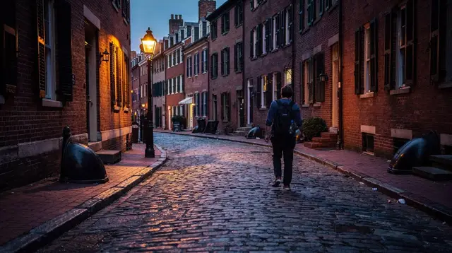
Lexington and Concord: the Battle Road day trip from Boston
How do you visit Lexington and Concord from Boston?
Lexington and Concord sit about 15 to 20 miles (24 to 32 km) northwest of Boston and are usually visited as a half-day or full-day trip, by car or by MBTA Commuter Rail from North Station. Driving is the easier way to link Lexington Green, the Battle Road Trail and the Old North Bridge in one outing; the train reaches both towns but not necessarily every site directly.
Where the Revolutionary War actually began
The Freedom Trail tells the Boston side of the Revolution: taxes, protests, a tea party in the harbor, a church steeple used to signal riders in the night. What it does not cover, because it happens outside city limits, is where the shooting started. That’s Lexington and Concord, two towns roughly 15 to 20 miles (24 to 32 km) northwest of Boston, connected by a road that British regulars marched along on April 19, 1775, and that colonial militia lined on the way back.
This guide treats the trip as what it is on the ground: a day out of the city, not a stop you fold into a morning walk on the Freedom Trail. It covers what’s actually there, how the pieces fit together, and how to get out and back without assuming a train schedule that hasn’t been published yet.
Lexington Green: the first shots
Lexington Green is a triangular common in the center of Lexington, unremarkable to look at, and that’s part of the point — nothing about the setting suggests what happened here. Before dawn on April 19, 1775, a small company of colonial militia gathered on the green after word came that British troops were marching from Boston, in part because of Paul Revere’s ride the night before. A shot was fired — no one has ever definitively established by which side — and in the exchange that followed, eight militiamen were killed. It was over in minutes, and the British column continued on toward Concord.
Today the green holds a statue of a militiaman, several period markers, and the Buckman Tavern where militia had gathered that morning, open seasonally as a house museum. There’s no fee to walk the green itself and read the markers; guided walking tours add context that the plaques alone don’t give, particularly on how contested the order of events still is among historians.
a guided walk across Lexington Green with a historian who covers what the plaques leave outMinute Man National Historical Park and the Battle Road Trail
Between Lexington and Concord, the National Park Service manages Minute Man National Historical Park (nps.gov/mima), which preserves the corridor the British column marched through — and was fired on from — that same day. The park’s centerpiece is the Battle Road Trail, a walking and biking path of roughly 5 miles (8 km) that follows the historical route, with a section that runs on the actual colonial-era road rather than a modern reconstruction.
Along the trail: historical markers explaining specific skirmishes, several preserved colonial-era buildings including the Hartwell Tavern area, and open fields and stone walls that still look close to how they would have in 1775 — colonial militia used those same walls for cover as the British retreated. There are two visitor centers, one near the Lexington end and one nearer Concord (the North Bridge Visitor Center), each with exhibits and rangers who can point you to the sections worth walking if you don’t have time for the full 5 miles.
Walking the whole Battle Road Trail end to end, with stops, takes several hours. Most day-trippers walk a shorter stretch — often the section around Hartwell Tavern — rather than the full route, and that’s a reasonable trade-off if you’re also trying to see Lexington Green and the Old North Bridge in the same day.
a trolley tour that covers the Battle Road corridor without requiring the full walkThe Old North Bridge in Concord
At the Concord end of the corridor is the Old North Bridge, a reconstructed wooden footbridge over the Concord River. This is where the fighting turned: colonial militia, having gathered in larger numbers than the British expected, forced a retreat at the bridge, and the British column’s long, costly withdrawal back toward Boston began — under fire for most of the march. Ralph Waldo Emerson’s 1837 poem gave the encounter its enduring phrase, “the shot heard round the world,” and the line is inscribed near the site.
The bridge and the surrounding North Bridge unit of the park are free to visit, with a visitor center nearby offering exhibits and a short film on the day’s events. It’s a quieter, more contemplative site than Lexington Green — fewer markers competing for attention, more open riverside space — and a natural place to end the day if you’re driving back toward Boston afterward.
How the day actually fits together
The honest version: Lexington Green, a meaningful stretch of the Battle Road Trail, and the Old North Bridge are three separate locations spread across two towns, and covering all three properly is a full day, not a rushed morning. A half-day trip usually means choosing between a longer walk on the Battle Road Trail or a slower, more thorough visit to both endpoints — trying to do both in three or four hours tends to mean seeing everything from a car window.
| Stop | What it is | Typical time |
|---|---|---|
| Lexington Green | Site of the first shots, statue, tavern | 30–60 min |
| Battle Road Trail (partial) | Walking path, markers, historic buildings | 1.5–3 hours |
| Old North Bridge, Concord | Reconstructed bridge, visitor center | 45–90 min |
| Concord center | Shops, additional historic houses | 30–60 min |
A full day, including travel time from Boston, comfortably fits all four. A half-day trip should pick two.
Getting there: driving versus the Commuter Rail
By car, Lexington and Concord are roughly 20 to 40 minutes from central Boston depending on traffic and which site you’re headed to first, and driving is the more practical way to link Lexington Green, a stretch of the Battle Road Trail, and the Old North Bridge without backtracking. Parking is available at both park visitor centers and around each town center, though it can fill on weekends during peak season.
The MBTA Commuter Rail also runs from North Station out toward Concord and the general Lexington area — this is a separate network from the T, with its own ticketing, covered in our Commuter Rail day trips guide. The important caveat: the train does not necessarily drop you within easy walking distance of the park’s main sites in both towns, and connecting between stations and the actual historic sites may require a local bus, a taxi, or a fair amount of walking. Schedules and stops change, so check mbta.com directly before planning a train-only day, rather than relying on older write-ups — this guide deliberately doesn’t quote specific train times because they’re the kind of detail that goes stale fast.
If you’d rather not deal with either option, a guided day trip handles the routing for you.
a private guided day trip from Boston that covers Lexington and Concord’s Revolutionary War sites without the logisticsFor a broader look at renting a car for this and other trips outside the city, see our guide to renting a car in Boston.
The connection back to Boston: Paul Revere’s ride
The reason Lexington and Concord belong in a Boston travel guide, rather than just a Massachusetts one, is the night before the fighting. On the evening of April 18, 1775, signal lanterns were hung in the steeple of the Old North Church in Boston’s North End — “one if by land, two if by sea” — to warn that British troops were crossing the Charles River by boat. Paul Revere then rode out toward Lexington to warn colonial leaders John Hancock and Samuel Adams, and to alert militia along the route, that the British column was on its way.
That ride is why the fighting happened where it did the next morning: colonial militia in Lexington had already been warned and had time to gather on the green before the British arrived. Walking the Freedom Trail in Boston and then following the Battle Road Trail in Lexington and Concord is, in effect, walking the same story from two different nights and mornings, roughly 15 miles apart.
Rural New England, not Boston’s density
Part of what makes this trip worth the drive is the contrast with the city. The Freedom Trail moves through dense, built-up Boston neighborhoods — the North End, Beacon Hill, the Financial District. Lexington and Concord are quieter New England towns: village greens, colonial-era houses, stone walls, open fields along the Battle Road Trail that still look agricultural rather than suburban. It’s a genuinely different pace and setting, not just a further-out version of the same historic-sites experience, and that’s worth knowing before you go if you’re expecting something closer to a Boston neighborhood.
When to go
Spring and fall are the most comfortable seasons for walking the Battle Road Trail — summer along the exposed sections can be hot with limited shade, and winter conditions vary depending on snow. If you’re visiting in the weeks around fall foliage season, the rural stretch of the Battle Road Trail is one of the better places near Boston to see color away from crowds, since most foliage traffic concentrates further north and west.
April 19 itself — Patriots’ Day — brings reenactments and much larger crowds to both towns, including an early-morning reenactment on Lexington Green. It’s a genuinely different experience from a normal day trip and worth planning around specifically if that’s what you’re after, rather than showing up expecting a quiet visit.
Other day trips from Boston with a similar shape
If the appeal of Lexington and Concord is getting out of the city for a day of history in a smaller-town setting, Salem and the North Shore offer a comparable trip in the opposite direction, with witch trial history rather than Revolutionary War history, and a working fishing port instead of a battlefield. Both are covered in more detail in our day trips overview.
Lexington and Concord day trip: questions answered
Is Lexington and Concord part of the Freedom Trail?
No. The Freedom Trail is a 2.5-mile (4 km) walking route inside Boston connecting 16 sites. Lexington and Concord are separate towns to the west, covered by the Minute Man National Historical Park, but they continue the same Revolutionary War story the Freedom Trail tells in the city.
Can Lexington and Concord be done in half a day?
A rushed half-day can cover Lexington Green and the Old North Bridge, but seeing a real stretch of the Battle Road Trail and the museums in both towns comfortably takes a full day. Trying to fit everything into a morning usually means picking one town over the other.
Do you need a car to visit Lexington and Concord?
A car makes it easier to connect Lexington Green, the Battle Road Trail visitor centers and the Old North Bridge in one trip. The Commuter Rail from North Station reaches Concord’s town center and a station in Lexington’s area, but neither drops you at the park’s main sites, so check current routes and walking distances before relying on the train alone.
What is the Battle Road Trail?
The Battle Road Trail is a roughly 5-mile (8 km) walking and biking path inside Minute Man National Historical Park, following the route British troops marched and fought along on April 19, 1775, between Lexington and Concord. Part of it runs on the original colonial-era road.
What happened at Lexington Green and the Old North Bridge?
Lexington Green is where colonial militia and British troops exchanged the first shots of the Revolutionary War on the morning of April 19, 1775. The fighting continued at the Old North Bridge in Concord, where militia forced the British to retreat — the encounter later called the shot heard round the world.
Is there an entrance fee for Minute Man National Historical Park?
The park itself, including Lexington Green, the Battle Road Trail and the Old North Bridge, is free to visit. Some individual historic houses along the way, such as the Hartwell Tavern area, may have separate seasonal hours or small fees for guided programs — check nps.gov/mima for the current schedule.
How does this trip connect to the Freedom Trail and Paul Revere’s ride?
Paul Revere’s midnight ride on April 18, 1775, set out from Boston’s North End to warn colonial leaders in Lexington that British troops were coming. The Old North Church, a Freedom Trail stop, is where signal lanterns were hung to start that ride, making Lexington and Concord a direct continuation of the same night.
Freedom Trail and Revolutionary history tours on GetYourGuide
Verified deep-linked GetYourGuide tours. Book through these links and we earn a small commission at no cost to you.
GetYourGuide does not provide a product photo for this activity — the image shows the meeting point, photographed by us.