The MBTA and the T: a guide to Boston's subway
What is the T in Boston?
The T is the nickname for the MBTA subway, the oldest underground transit system in the United States. It runs four color-coded lines plus a Silver Line of bus rapid transit, and it covers most of downtown Boston, Back Bay, Fenway, and Cambridge.
How Boston’s subway actually works
Boston’s subway network is nicknamed the T, short for the Massachusetts Bay Transportation Authority, or MBTA, the agency that runs it. Opened in 1897, it is the oldest underground rapid transit system in the United States, and its age shows in some of the older stations even as large sections have been rebuilt over the decades. For a visitor, what matters is simpler: the T is the fastest way to move between downtown Boston, Back Bay, Fenway, and Cambridge, and understanding its structure before you arrive saves real time.
The system is organized around four color-coded subway lines, a bus rapid transit line called the Silver Line, an extensive local bus network, and a separate regional rail system called the Commuter Rail. These are not interchangeable, and mixing them up is the most common mistake visitors make. This guide covers the subway and bus side of things; for the regional trains that reach towns like Salem or Plymouth, see Commuter Rail day trips.
The four subway lines
- Red Line — Runs from Alewife in North Cambridge through Harvard Square, Kendall/MIT, downtown Boston (Park Street, Downtown Crossing), and south to Dorchester and Quincy. It is the line most visitors use to reach Cambridge.
- Green Line — A network of surface and underground trolley branches (B, C, D, E) running from downtown through Back Bay, the Fenway area, and out to Brookline and Newton. It is the slowest of the four because several branches run in mixed traffic at street level.
- Orange Line — Runs north-south through downtown, connecting North Station, Downtown Crossing, and Back Bay to neighborhoods further out.
- Blue Line — Runs from downtown (connecting at Government Center and State) out to East Boston and Logan International Airport’s Airport station, then continues to Revere.
These four lines converge in the downtown core, so most cross-town trips involve a single transfer at a shared station such as Park Street, Downtown Crossing, or Government Center.
The Silver Line: a bus that acts like a subway
The Silver Line is a set of bus rapid transit routes that run in dedicated lanes and, downtown, through a tunnel, which is why the MBTA groups it with the subway rather than the regular bus network. The SL1 branch connects Logan International Airport to South Station and is free in the airport-to-city direction; the return trip is a standard T fare. Other Silver Line branches serve the Seaport district and the South End. See getting from Logan to Boston for the full airport-transfer picture.
The regular bus network
Beyond the Silver Line, the MBTA runs a large network of local buses that reach neighborhoods the subway does not, including much of the North End’s approach streets, parts of Beacon Hill, and Cambridge beyond the Red Line corridor. Buses use the same CharlieCard as the subway, and transfers between bus and subway are generally included within the standard transfer window.
The CharlieCard: how fares work
Fares on the T are paid with a CharlieCard, a small reloadable plastic card that you tap on a reader at a subway fare gate or on a bus. It can be loaded with stored value (pay per ride) or with a time-based pass, and transfers between the subway and connecting buses are typically included within a set window after your first tap. Paper CharlieTickets work the same way but are usually a few cents more expensive per ride than a CharlieCard, and contactless bank card or phone payment is also accepted at most stations and on buses.
This guide does not quote an exact fare, because prices change and the current per-ride cost, pass options, and transfer rules should always be checked directly on mbta.com before you travel. As a rough point of reference, the base subway and bus fare has recently sat in the neighborhood of $2.40 per ride, with transfers between bus and subway folded into a two-hour window rather than charged separately — but treat that figure as a ballpark, not a quote, and confirm the current number on mbta.com before you budget a trip around it. What matters for planning is the principle: buy or tap once, and the system handles transfers automatically within its window, rather than requiring a new fare for every leg of a trip.
CharlieCards are sold at subway station vending machines and some retail locations; a limited-use paper CharlieTicket can also be bought from the same machines if you would rather not carry a plastic card for a short visit.
A real constraint: the T does not run all night
One thing that surprises visitors from cities with round-the-clock subways: the T does not run 24 hours a day. Each line stops running late at night and resumes the following morning, and the exact closing and opening times differ by line and sometimes by day of the week, so this guide will not print a single closing time as if it applied everywhere.
The practical effect is that an evening out in the North End, Fenway, or Cambridge needs a plan for getting home. Before you head out for dinner, a game, or a late walk along the Freedom Trail, check the last scheduled train on mbta.com for the specific line and station you will be using. If you miss it, ride-hailing apps and taxis operate normally after the T closes, but they cost more than the fare you budgeted for the subway. This matters most after a Red Sox night game at Fenway Park or a late dinner in the North End, both of which can run past a line’s last train depending on the night.
The Commuter Rail is a different system
It bears repeating because it trips up first-time visitors constantly: the Commuter Rail is a separate regional rail network from the subway, run by the same MBTA but with its own ticketing, schedule, and stations. A CharlieCard loaded for subway and bus travel does not work on the Commuter Rail; tickets are bought separately, often through the MBTA’s mobile app or at station kiosks.
The Commuter Rail is what you want for day trips beyond the subway’s reach — Salem and the North Shore, Plymouth, and Concord are all realistic Commuter Rail trips from North Station or South Station. The subway lines described above stay within Boston, Cambridge, and their immediate inner suburbs. For the full comparison and specific route advice, see Commuter Rail day trips from Boston.
| Network | What it connects | Fare card |
|---|---|---|
| Subway (Red, Green, Orange, Blue) | Downtown Boston, Back Bay, Fenway, Cambridge | CharlieCard / CharlieTicket |
| Silver Line | Airport, Seaport, South End, downtown | CharlieCard / CharlieTicket |
| Local buses | Neighborhoods beyond subway stations | CharlieCard / CharlieTicket |
| Commuter Rail | Salem, Plymouth, Concord, and other suburbs | Separate ticket, own system |
Which Commuter Rail trips people actually take
The Commuter Rail lines that matter most for a Boston-based visitor without a car run north and south out of the two downtown terminals. From North Station, trains reach Salem on the North Shore, useful for the Salem day trip guide and for planning around Salem’s October crowds if you’re visiting during Haunted Happenings. From South Station, trains reach Plymouth, covered in the Plymouth day trip guide. Neither Lexington nor Concord has its own Commuter Rail stop right in the historic center, so day trips there typically combine a short rail or bus leg with a short drive or rideshare — see the Lexington and Concord day trip guide for the specifics, or the Lexington–Concord itinerary for a single-day route along the Battle Road. If you’re weighing the North Shore against a Commuter Rail day generally, the Salem and North Shore day trip itinerary lays out a full day’s pacing.
None of these are subway trips. The T’s four color-coded lines and the Silver Line stay within Boston, Cambridge, and their immediate inner suburbs; the Commuter Rail is the layer above that, with its own ticketing at North Station and South Station kiosks or through the MBTA’s app, bought separately from any CharlieCard balance.
Bluebikes is not the T
Bluebikes is Boston’s bike-share system, with docking stations across the city and Cambridge. It is operated separately from the MBTA, has its own app, membership, and pricing, and a CharlieCard does nothing on a Bluebikes dock. It’s worth knowing about as a complement to the T, particularly for shorter hops along the Charles River or between neighborhoods the subway serves indirectly, but it is a different service entirely.
Using the T to reach the main tourist areas
For orientation, here is how the subway lines map onto the areas most visitors spend time in:
- Freedom Trail, North End, Beacon Hill, downtown — Served by all four lines converging at Park Street, Government Center, State, and Downtown Crossing. Much of the Freedom Trail itself is walkable once you reach downtown, so the subway gets you to the start rather than along the whole route.
- Back Bay and Fenway — Green Line and Orange Line, with Back Bay and Hynes Convention Center stations serving Back Bay, and Kenmore or Fenway station near Fenway Park.
- Cambridge (Harvard, MIT) — Red Line to Harvard or Kendall/MIT. Cambridge is a separate city across the Charles River, not a Boston neighborhood, and the Red Line is the direct way there; see the guide to Harvard and MIT for what’s on each campus, or the Cambridge Harvard Square neighborhood guide for the area around the stop itself.
- Seaport and the waterfront — Silver Line branches, plus a short walk from South Station on the Red Line.
If you are choosing where to stay based on how easily you can reach these areas by subway, our neighborhood guide weighs T access alongside walkability and price.
Planning without a car
For most visitors staying in Boston, Cambridge, or Back Bay, the T plus walking covers the majority of a trip’s needs, and driving downtown adds parking costs and traffic that the subway avoids entirely. The exceptions are day trips beyond the Commuter Rail’s reach, overnight trips to Cape Cod or the islands, and travel timed around the T’s overnight closure. Our broader guide to getting around Boston without a car puts the T in context alongside walking, Bluebikes, ride-hailing, and the Commuter Rail, and is the better starting point if you’re still deciding whether to rent a car at all.
A guided option removes the transit-planning question altogether for a day: a private custom tour with a local guide can route around T schedules and station walks, useful if you’re short on time or traveling with people who’d rather not navigate fare gates. For a specific itinerary, a guided Freedom Trail walk in French starts downtown, right where several subway lines converge, and a guided tour of Harvard, MIT, and the surrounding historic sites covers Cambridge without you needing to work out the Red Line transfer yourself. If your evening plans include a night game, a guided Fenway Park ballpark tour is worth timing around the T’s last train on the Green Line back to your hotel.
A system that shows its age
Part of what makes the T distinctive is also what occasionally slows it down: it is the oldest subway system in the country, and stretches of track, especially on the Green Line’s older branches, were never designed for the ridership they now carry. Delays and single-tracking happen, particularly during rush hour or after a heavy snowfall, and a first-time visitor used to a newer system can be caught off guard by a Green Line trolley running well behind its posted interval.
None of this changes the basic advice above — the T is still the fastest way to cover downtown Boston, Back Bay, Fenway, and Cambridge without a car — but it’s worth building a little slack into a tight schedule, especially before a flight out of Logan or a dinner reservation across town. Our piece on riding the T and its old age goes deeper into what that history looks like from inside a rush-hour train, if you want the fuller picture beyond the practical basics here.
If you’re mapping the T against a full stay rather than a single day, it’s worth pairing this guide with a broader itinerary: the two-day Boston highlights itinerary and the three-day first-visit itinerary both build their pacing around subway access between neighborhoods, so you can see where the T saves time and where walking is simply faster once you’re already downtown.
Frequently asked questions about the T
What does MBTA stand for?
Massachusetts Bay Transportation Authority, the public agency that runs the T, the bus network, and the Commuter Rail across greater Boston.
How many subway lines does the T have?
Four color-coded rapid transit lines: Red, Green, Orange, and Blue, plus the Silver Line, which uses buses running in dedicated lanes and tunnels rather than trains.
What is a CharlieCard?
A reloadable plastic fare card used to pay for subway and bus rides. You tap it at a fare gate or bus reader; it can also be loaded with multiple rides or passes. Paper CharlieTickets and contactless payment are also accepted on most of the system.
Does the T run all night?
No. Service stops overnight and resumes in the morning, with hours that differ by line and by day of the week. Always check the last train on mbta.com before an evening out.
Is the Commuter Rail the same as the T?
No. The Commuter Rail is a separate regional rail network with its own ticketing, used for longer trips to the suburbs and towns like Salem or Plymouth. A CharlieCard loaded for the subway does not work on the Commuter Rail.
Can I use the T to get to Cambridge?
Yes. The Red Line crosses the Charles River and stops at Harvard and Kendall/MIT, making it the most direct way to reach Cambridge from downtown Boston.
Does the T go to the airport?
Indirectly. The Silver Line SL1 bus connects Logan International Airport to South Station, and a free Massport shuttle links airport terminals to the Blue Line’s Airport station.
Is Bluebikes part of the MBTA?
No. Bluebikes is a separate bike-share system with its own membership and pricing, unrelated to the T or its fare cards.
Getting around Boston on GetYourGuide
Verified deep-linked GetYourGuide tours. Book through these links and we earn a small commission at no cost to you.
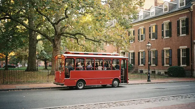
GetYourGuide does not provide a product photo for this activity — the image shows the meeting point, photographed by us.