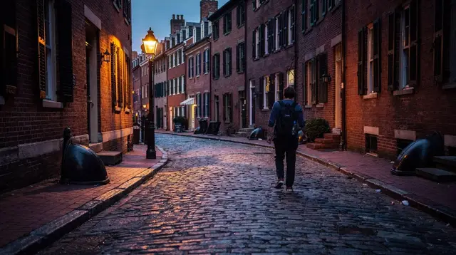
South End neighborhood guide: bow-fronts, SoWa and street art
What is the South End known for and how is it different from Back Bay or Beacon Hill?
The South End is a residential Boston neighborhood of Victorian bow-front rowhouses, centered on the SoWa (South of Washington) area, known for its contemporary art scene, weekend open-air art and design market, and dining. It sits south of Back Bay and is more contemporary and diverse in character than the postcard formality of Beacon Hill or Back Bay.
A neighborhood south of Back Bay, not a Freedom Trail stop
The South End sits directly south of Back Bay, separated from it mostly by the rail corridor that runs toward Back Bay station. It has nothing to do with the Freedom Trail’s downtown route of colonial and revolutionary sites, and nothing to do with the North End’s Italian streets across the city. If a guidebook or an itinerary lumps the South End in with either of those, it is working from an outdated map. The confusion is understandable from the name alone — South End sounds like it could be part of downtown, or a southern extension of the historic core — but it developed later, on landfilled marshland, as a Victorian residential district built mostly between the 1850s and the 1870s.
That later start is exactly what gives the neighborhood its character today. Where Beacon Hill trades on 19th-century formality and Back Bay on wide boulevards and museum-grade architecture, the South End reads as lived-in and current: long blocks of bow-front rowhouses with small front gardens, converted industrial buildings holding galleries and studios, and a restaurant and bar scene that draws Bostonians as much as visitors. It is also widely recognized, as a matter of general civic history, as one of the city’s most diverse residential neighborhoods and as a longstanding center of Boston’s LGBTQ community — background worth knowing, though this guide focuses on what there is to see and do on a visit rather than that social history itself.
This guide treats the South End as its own stop: how to get there, what the bow-front streets and SoWa’s gallery cluster actually offer, where the neighborhood’s food reputation comes from, and how to pair it with a visit to Back Bay or the rest of central Boston without wasting a transfer.
Getting there: Orange Line and Silver Line, not a downtown walk
The South End is not reachable by the T’s Green Line branches that serve Back Bay’s Newbury Street side, which trips up visitors who assume all of Back Bay-adjacent Boston shares one station. Two lines actually serve it:
| Station | Line | Best for |
|---|---|---|
| Back Bay | Orange Line | Western South End, Tremont Street, Union Park |
| Tufts Medical Center | Orange Line, Silver Line | Eastern South End, Washington Street, SoWa |
Back Bay station is a major hub — it also carries Commuter Rail and Amtrak — so it is a natural transfer point if you are combining a South End visit with a Back Bay walk or an arrival from outside the city. From Back Bay station, most of the bow-front core is a 10-to-15-minute walk south. Tufts Medical Center station puts you closer to the Washington Street corridor and SoWa. Either way, this is standard T fare with the CharlieCard transfer window that applies system-wide; see the general guide to getting around Boston without a car for how the fare and transfer rules work if you are combining this with other stops.
Walking in from Back Bay along Clarendon or Dartmouth Street is a reasonable way to feel the transition between neighborhoods — the architecture shifts from Back Bay’s uniform brownstone blocks to the South End’s more varied bow-front rows within a few minutes.
Bow-front rowhouses: the neighborhood’s signature architecture
The South End holds one of the largest concentrations of intact Victorian bow-front rowhouses in the country, and it is worth understanding what that means before wandering it. “Bow-front” refers to a curved, rounded bay on the front facade — as opposed to the flat-fronted or angular-bayed rows common elsewhere in Boston — and the effect, repeated down an entire block, is a rhythmic curve of brick and brownstone rather than a straight wall. Most of this housing dates from roughly 1850 to 1875, built on landfilled tidal marsh at the same time Back Bay itself was being filled and developed, though on a different plan: narrower streets, smaller front gardens, and park squares such as Union Park and Rutland Square that function as shared green space for the surrounding blocks.
Because the South End was built as middle-class rowhouse housing rather than as a showcase boulevard, the architecture reads less formal than Back Bay’s Commonwealth Avenue and less uniformly preserved than Beacon Hill’s brick lanes — some blocks are immaculately restored, others still show the neighborhood’s mid-20th-century decline and later revival. That mix is part of what makes it feel like a real, occupied neighborhood rather than a stage set. Union Park Street and Rutland Square are commonly cited as some of the best-preserved bow-front blocks; a slow walk through either gives a sense of the pattern without needing a formal tour.
SoWa: galleries, studios and a weekend market
SoWa stands for South of Washington Street, and it refers to a cluster of former industrial buildings along and around Harrison Avenue and Thayer Street that now hold artist studios, galleries, and design showrooms. It is the closest thing the South End has to a single must-see cluster, and it is also where the neighborhood’s street art concentrates — building-side murals and rotating installations that change over time, rather than a fixed outdoor gallery.
On weekends during the warmer months, SoWa runs an open-air market with art, design, and food vendors set up along the street and in adjacent lots. Exact days, hours, and the market’s seasonal calendar shift from year to year, so this guide will not commit to specific dates or times — check the market’s own current listing before building a trip around it, and have a backup plan (the gallery buildings themselves, which keep more consistent weekday and weekend hours) if you arrive on an off day. Individual galleries and studios rotate their own artists and shows regularly enough that naming specific ones here would be out of date within months; treat SoWa as a place to browse on the day rather than a fixed checklist.
Because SoWa’s draw is partly about atmosphere and partly about whatever happens to be showing that week, it rewards unhurried time more than a tight schedule. Pair it with lunch in the neighborhood rather than trying to fit it into a rushed stop between other Boston sights.
Food and drink: the South End’s other reputation
Alongside its architecture and art scene, the South End is widely recognized as one of Boston’s stronger neighborhoods for dining, with a concentration of independent restaurants along Tremont and Washington Streets that draws locals from across the city, not just visitors. This guide will not attempt to rank specific restaurants — that changes too fast for a static page to stay honest — but a guided food walk is a practical way to sample several spots in one outing rather than gambling on a single reservation.
a South End food tour that pairs sweet and savory stops through the neighborhood covers this ground directly, with a route built around several small tastings rather than one sit-down meal.
If you would rather cover Boston’s food scene more broadly and compare South End stops against other neighborhoods, a broader Boston street food tour with a local guide is the wider-lens alternative, useful if you want context on how the South End’s food scene fits into the rest of the city rather than a South End–only route.
If cocktails and a later evening are more the plan, the South End also has a handful of speakeasy-style bars; the separate guide to Boston’s speakeasy and cocktail scene covers that ground rather than duplicating it here.
Walking it yourself vs. a guided visit
The South End rewards slow walking more than most Boston neighborhoods, since its appeal is cumulative — one bow-front block, then another, then a gallery, then a park square — rather than built around a single landmark you can photograph and move on from. A self-directed loop through Union Park, Rutland Square, and the SoWa cluster, with a stop for food, covers the neighborhood’s essentials in two to three hours without needing a fixed itinerary.
That said, a guided option makes sense if you want context on the architecture and the neighborhood’s development that a self-guided walk will not supply on its own, or if you are combining the South End with other parts of the city in a single outing and would rather not plan the routing yourself.
a private custom tour with a local guide that can be built around the South End specifically is the most flexible way to do this, since a private guide can weight the route toward architecture, art, or food depending on what you actually want to see, rather than following a fixed script.
For a general primer on how Boston’s various walking tour formats differ — guided vs. self-guided, neighborhood-specific vs. citywide — the Boston walking tour guide lays out the tradeoffs without repeating them here.
How the South End compares to Back Bay and Beacon Hill
Visitors often ask whether the South End is worth adding alongside Back Bay and Beacon Hill, given limited time. The short answer is that the three neighborhoods do different things, and the South End is the one most likely to feel unfamiliar if your only reference point for Boston is the Freedom Trail and the museum district.
| Neighborhood | Architecture | Character | Nearest T access |
|---|---|---|---|
| Beacon Hill | Federal-era brick, gas lamps | Formal, historic, quiet | Park Street, Charles/MGH |
| Back Bay | Uniform brownstone boulevards | Museums, shopping, Commonwealth Ave | Back Bay, Copley |
| South End | Victorian bow-front rows | Contemporary, art-focused, dining-driven | Back Bay, Tufts Medical Center |
Beacon Hill and Back Bay both sit closer to Boston’s traditional sightseeing core and are easier to fold into a Freedom Trail–adjacent day. The South End is a deliberate addition rather than something you stumble into on the way between other sights, which is part of why it stays less crowded even on a busy weekend. For a wider overview of Boston’s neighborhoods and how they fit into a first visit, the Beacon Hill neighborhood guide and the general Back Bay brownstones walking tour guide are useful companion reads, and the first-time Boston guide covers how much of the city a typical visit can realistically cover.
If your interest in the South End is specifically architectural, pairing it with the Back Bay brownstone walk makes sense as a single afternoon, since the two neighborhoods sit back to back and the contrast between their building styles is easiest to appreciate when seen close together. If your interest leans toward food and galleries, treat the South End as a standalone half-day rather than trying to compress it into a longer downtown itinerary.
Practical notes for a South End visit
A few things worth knowing before setting out. The neighborhood’s main commercial spine runs along Tremont Street and Washington Street, with SoWa concentrated toward the Washington Street end nearer Tufts Medical Center station. Most galleries and shops keep afternoon and evening hours rather than opening early, so a South End visit generally works better after late morning than as a first stop of the day. There is no single South End “sight” comparable to a museum or a Freedom Trail site — the appeal is the neighborhood itself, so budget unstructured walking time rather than expecting a checklist of stops.
For a broader sense of Boston’s museum options if you plan to pair a South End visit with a nearby cultural stop, the Boston museums guide and the guide to the Isabella Stewart Gardner Museum both sit within reasonable walking or transit distance from the South End’s western edge near Back Bay. And if budget is a factor, the free things to do in Boston guide is worth checking, since walking the South End’s streets and browsing SoWa’s public-facing storefronts costs nothing beyond the T fare to get there.
South End, Boston: frequently asked questions
Is the South End part of the Freedom Trail or downtown Boston?
No. The South End is a separate residential neighborhood south of Back Bay, with no Freedom Trail sites. It developed later than the Freedom Trail’s colonial and revolutionary sites, as Victorian-era landfill housing.
How do I get to the South End on the T?
The Orange Line to Back Bay station or to Tufts Medical Center station puts you within walking distance of most of the South End. The Silver Line also serves the neighborhood’s eastern edge near Tufts Medical Center.
What is SoWa and when is the market open?
SoWa stands for South of Washington Street, a stretch of the South End with galleries, studios, and an open-air market for art, design, and food vendors that runs on weekends during the warmer months. Exact days and hours change seasonally, so check the market’s own current listing before planning a visit.
Is the South End walkable from Back Bay?
Yes. The South End borders Back Bay directly, and most visitors reach it on foot in 10 to 15 minutes from Back Bay station or Copley Square, crossing over or near the rail corridor that separates the two neighborhoods.
Is the South End safe and good for a day visit?
The South End is a well-established residential neighborhood popular with locals for dining and gallery visits, and it draws steady daytime foot traffic. As anywhere in a city, standard precautions apply, and it is best explored during daylight or early evening when shops and restaurants are open.
What makes the South End’s architecture distinct?
The South End has one of the largest concentrations of intact Victorian bow-front rowhouses in the United States, built mostly from the 1850s through the 1870s on landfilled ground, with bay windows, brick facades, and small front gardens along tree-lined streets.
Neighborhood tours of the North End, Beacon Hill and Cambridge on GetYourGuide
Verified deep-linked GetYourGuide tours. Book through these links and we earn a small commission at no cost to you.
GetYourGuide does not provide a product photo for this activity — the image shows the meeting point, photographed by us.