Back Bay brownstones: a walking guide to the architecture
What's the best way to see Back Bay's brownstones?
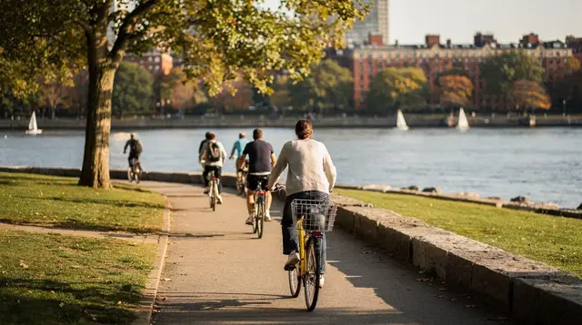
Walk the four parallel streets between the Public Garden and Massachusetts Avenue — Commonwealth Avenue Mall, Marlborough Street, Newbury Street and Boylston Street — on foot, at street level, since the brownstones are private residences. Reach the neighborhood via the T's Copley or Back Bay stations, and plan roughly 90 minutes to two hours for a full pass, including Copley Square.
A neighborhood built on filled land
Back Bay looks like one of the oldest parts of Boston, and in one sense it is: the brownstone rows along Commonwealth Avenue, Marlborough Street and Newbury Street read as solidly 19th-century as anywhere in New England. But the ground under them didn’t exist as dry land until the 1850s. What’s now Back Bay was a tidal marsh and mudflat off the Charles River, filled in gradually over roughly three decades using gravel hauled in by train from Needham. Building lots were sold off and developed street by street as the filling progressed, west from the Public Garden toward what’s now Massachusetts Avenue. That’s why the neighborhood reads as unusually planned for a 19th-century American city: it was laid out on a formal grid from the start, rather than growing organically the way older parts of Boston did.
This guide is about walking that grid to look at the architecture — not about touring a museum or a single site, but about reading a streetscape that was, at the time it went up, one of the more fashionable addresses in the country. Almost everything you’ll be looking at is a private home or a converted apartment building, so the walk happens entirely at street level.
The Public Garden, free to enter and the natural starting point at the eastern edge of Back Bay, is a useful bookend to this walk: it’s the last stretch of older, irregular Boston before the grid takes over, and it’s part of the Emerald Necklace park system that continues past the western edge of the neighborhood.
Getting there
The most direct approach is by the T. Copley station, on the Green Line, puts you at the western edge of Copley Square, within a block of Trinity Church and the Boston Public Library, and an easy walk into the brownstone streets. Back Bay station, on the Orange Line (and also a separate Commuter Rail and Amtrak stop, with its own ticketing), sits a few blocks south, near the Christian Science Plaza and the southern end of the neighborhood. Either station works; which one to use mostly depends on which end of the walk you want to start from. For fares and how transfers work, see the guide to the T; Back Bay is also close enough to downtown that some visitors walk in from Boston Common or the Public Garden instead of taking transit at all.
The four streets
Back Bay’s residential core runs between the Public Garden and Massachusetts Avenue as a series of parallel streets, laid out roughly east to west. From the Charles River side to Boylston Street, the order is Beacon Street, Marlborough Street, Commonwealth Avenue, Newbury Street, then Boylston Street. Each has a distinct character.
Commonwealth Avenue Mall is the spine of the neighborhood: a landscaped median running down the center of the avenue, planted with elm and other shade trees and lined with statues of 19th-century Bostonians. The brownstones facing it on both sides are generally the largest and most architecturally elaborate in the neighborhood — this was the address, and the scale of the houses reflects that. Walking the mall itself, rather than the sidewalk, gives the best sightlines to the facades on both sides at once.
Marlborough Street, one block toward the river, is quieter and more residential in feel, with narrower townhouses and less traffic. It’s a useful contrast to Commonwealth Avenue: same building era, more modest scale.
Newbury Street has the same brownstone construction as the other three, but almost every ground floor has been converted to retail — galleries, boutiques, cafés — while the upper floors remain residential. It’s the one street in this group where you’ll actually go in and out of doorways, since many of the shops occupy what were originally entry parlors. Its concentration of chocolate shops and small galleries is enough of a draw on its own that a guided chocolate and art galleries tour of Back Bay is built entirely around this one street, rather than the wider neighborhood. The street’s uniform bay-window facades also make it one of the more reliable stops on the Boston photo locations guide, if photography is part of the reason you’re walking it.
Boylston Street, the southern edge, is busier and more commercial, with a mix of older buildings and 20th-century construction; it’s less about brownstone architecture and more a transitional street between Back Bay and the Fenway.
A workable route is to walk one of these streets west from the Public Garden to roughly Massachusetts Avenue, then cross over and walk a second street back east. Doing two of the four streets, plus a stop at Copley Square, is enough to get a real sense of the neighborhood without repeating yourself; doing all four in one outing is possible but starts to feel repetitive, since the architectural vocabulary — bay windows, mansard roofs, wrought-iron railings, brownstone or brick facades — repeats block to block by design.
What you’re actually looking at
The term “brownstone” describes both a building material — a reddish-brown sandstone, much of it originally quarried in Connecticut — and, loosely, the whole style of rowhouse Back Bay is known for, even though plenty of the neighborhood’s buildings are faced in brick or limestone rather than true brownstone. What unifies them is the format: narrow, deep townhouses built in continuous rows, three to five stories, with a raised entrance (a “stoop”), tall windows, and a facade designed to read as part of a coordinated streetscape rather than a standalone building.
Because Back Bay was developed over roughly three decades, the architectural styles shift as you move west, tracking changes in taste through the second half of the 19th century — from the more restrained French Second Empire and mansard-roofed buildings near the Public Garden end, toward Queen Anne and Romanesque Revival detail (turrets, richer stonework, round arches) further out. None of this is signposted, so a self-guided walk rewards paying attention to how the facades change over the course of a few blocks, rather than looking for a single landmark.
Copley Square
At the western edge of the Commonwealth Avenue Mall and Newbury Street blocks, the residential grid opens onto Copley Square, where the architecture shifts register entirely. Trinity Church, completed in 1877, is a Romanesque Revival building designed by H. H. Richardson, considered one of the more significant works of American church architecture of its period; the interior includes murals and stained glass, and the church operates as an active parish with regular visiting hours and services — check its own site before planning around a specific time.
Facing it across the square is the Boston Public Library’s Copley Square building, a Renaissance Revival structure from the 1890s with a courtyard and reading rooms open to the public at no charge. The contrast between the two — a Gothic-influenced Romanesque church and a Renaissance-style library, facing off across a formal square — is itself one of the more deliberate pieces of urban design in the neighborhood, and worth building a pause into the walk.
Extending the walk to Christian Science Plaza
From Copley Square, it’s a short walk south to the Christian Science Plaza, home to the First Church of Christ, Scientist and its landmark basilica, along with a long reflecting pool and open plaza that reads very differently from the tight residential blocks a few minutes away. It’s not architecturally continuous with the brownstone streets — the plaza and its mid-20th-century buildings belong to a different era of construction — but it’s close enough, and open enough as public space, that many walks extend here as a natural endpoint, particularly if you started at Back Bay station on the Orange Line rather than Copley. The nearby Prudential Center also has an observation deck with views back down over the brownstone grid; see the View Boston Skywalk guide if a rooftop view over the neighborhood you’ve just walked appeals.
The social history behind the facades
Some walking tours of this neighborhood pair the architecture with the social history of who actually lived here — Back Bay was, from the start, one of Boston’s wealthiest residential addresses, built during and after the city’s Gilded Age, and its houses were designed to display that wealth as much as to shelter it. A tour framed this way will point out details tied to specific families, changing household technology (indoor plumbing, elevators, electric light) as it arrived street by street, and how the neighborhood’s demographics shifted over the 20th century as many single-family houses were subdivided into apartments.
That angle adds context a purely architectural walk won’t, though it depends on the specific tour — duration and depth vary by operator, so it’s worth checking what a given tour actually covers before booking. Immediately south, the South End’s street art and neighborhood guide covers a very different, more recent layer of the same general area, for anyone extending the day past Back Bay’s Victorian core.
a walking tour that pairs Beacon Hill and Back Bay in one route, run in French, is one option if you want a guide covering both of Boston’s classic 19th-century residential neighborhoods in a single outing. For a tour built specifically around Back Bay’s architecture and layered with three different areas of the city, a two-hour history and architecture walk across three neighborhoods covers more ground than a Back Bay-only route. If the social history angle interests you specifically, a tour focused on the women’s suffrage history of Back Bay ties specific addresses to that movement rather than treating the neighborhood as architecture alone.
Fall color on Commonwealth Avenue Mall
The tree canopy along the Commonwealth Avenue Mall is one of the more photographed stretches of urban fall foliage in Boston. Like the rest of New England, color typically builds from late September and peaks sometime in October, though the exact timing shifts year to year with weather, and city trees often turn a little later than trees further inland. It’s a pleasant walk in any season — summer shade, bare structure in winter that shows the architecture more clearly, since there are fewer leaves in the way — but if fall color is specifically the draw, plan the visit for the back half of the foliage season rather than its start, and check current conditions before committing to a special trip. The New England fall foliage guide covers the broader regional timing, useful if a Back Bay walk is one stop on a longer foliage trip.
Pace and what to skip
There’s no single correct route through Back Bay, and it’s not a checklist neighborhood the way the Freedom Trail is. A reasonable plan for a first visit: start at Copley station, look at Trinity Church and the library, walk one full block of Commonwealth Avenue Mall, cross to Newbury Street for the retail-lined stretch, and finish at Back Bay station or back at the Public Garden. That covers the essentials in under two hours without repeating the same facade style four times over. If you have more time, walking the full length of Marlborough Street adds the quietest, least touristed version of the same architecture — useful if the crowds on Newbury Street feel like too much.
For a comparison point, Beacon Hill, on the other side of the Public Garden, offers an earlier and narrower version of the same idea — brick rather than brownstone, built decades before Back Bay existed as dry land. Neither neighborhood is a better version of the other; they’re two different building periods that happen to sit a ten-minute walk apart, and seeing both back to back is one of the clearer ways to feel how quickly Boston’s architecture changed over the 19th century. The guide to Beacon Hill’s Acorn Street walk covers that comparison in more detail, and the Beacon Hill neighborhood guide is a useful companion if you’re doing both in one day.
Practical notes
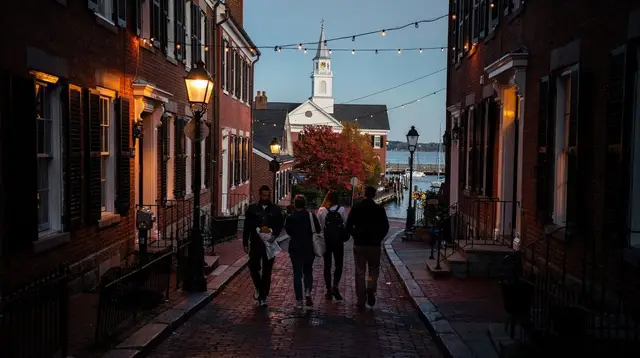
Back Bay’s brownstones are private residences. Treat the walk as you would any residential street: stay on the sidewalk, keep noise down, and don’t attempt to enter buildings or courtyards that aren’t clearly open to the public. A handful of buildings — mostly on Newbury Street — operate as shops, galleries or cafés with public ground floors, and those are fair to walk into during business hours. Everything else is viewed from outside only.
The neighborhood is flat and fully walkable, with curb cuts and wide sidewalks along the main streets, though individual building stoops are not accessible; see the accessible Boston guide if that’s a planning factor. There’s no admission fee to walk any of these streets — the cost, if any, is limited to a guided tour should you choose one over a self-guided walk. If this is your first visit to Boston and you’re still deciding how a Back Bay walk fits alongside downtown and the Freedom Trail, the first-time Boston guide and the how many days in Boston guide both cover how to budget time across neighborhoods.
For an overview of walking tours across the rest of the city, the Boston walking tour guide covers routes beyond Back Bay, including the Freedom Trail and North End food walks. And if you’re weighing whether to book a guide at all versus walking on your own — here or anywhere else in the city — self-guided versus guided comparisons apply the same logic to Back Bay as to the Freedom Trail: a self-guided walk costs nothing and works fine with a map, while a guide adds context you won’t get from a facade alone.
Back Bay brownstones: frequently asked questions
Can you go inside the brownstones?
No, almost all of them are private residences or divided into apartments and condos. What you’re looking at is the exterior architecture — facades, bay windows, ironwork, doorways — viewed from the sidewalk. A small number of buildings on Newbury Street operate as shops, galleries or offices with public ground floors, but that’s the exception, not the rule.
Is Back Bay a good neighborhood for walking, or do I need a car?
It’s one of the most walkable parts of Boston: flat, gridded streets laid out on filled land, with wide sidewalks and short blocks. No car is useful or necessary — the T’s Green Line and Orange Line both stop in the neighborhood.
How do I get to Back Bay by public transportation?
Take the T to Copley station on the Green Line, or to Back Bay station on the Orange Line (also a separate Commuter Rail and Amtrak stop, with its own ticketing). Both put you within a few minutes’ walk of Copley Square and the brownstone streets. See the guide to the T for fares and how the system works.
What’s the difference between Back Bay and Beacon Hill architecture?
Beacon Hill was built earlier, in the early 1800s, on the original hillside, with narrower brick rowhouses, gas lamps and cobblestone. Back Bay was built later, from the 1850s through the 1880s, on land reclaimed by filling in a tidal marsh, with wider streets laid out in a formal grid and larger, more ornate brownstone facades in Victorian styles. Neither is more authentic than the other — they’re two different building booms.
When is the best time to walk Commonwealth Avenue Mall?
The tree-lined mall down the center of Commonwealth Avenue draws the most attention in fall, when its canopy turns color, typically from late September into October, in line with the rest of New England’s foliage season. It’s also a pleasant walk in spring and summer; winter strips the trees but keeps the architecture fully visible.
Is a guided walking tour worth it, or can I do this myself?
Both work. A self-guided walk costs nothing and lets you set the pace — this guide gives you a workable route. A guided tour adds context on the social history of the neighborhood, including its Gilded Age residents, and a guide who can point out details a first-time visitor would otherwise miss; duration varies by operator, so check the specific listing.
Can I combine Back Bay with the Freedom Trail in one day?
Not comfortably on foot — they’re in different parts of the city and cover different periods of history, the Freedom Trail being colonial and revolutionary, Back Bay being 19th-century. Most visitors treat them as separate outings, though both are reachable by T in under 20 minutes from each other.
What’s inside Trinity Church and the Boston Public Library on Copley Square?
Trinity Church is an active Episcopal parish open for visits and services, known for its Romanesque architecture and interior murals. The Boston Public Library’s Copley Square building has a free-to-enter courtyard and reading rooms open to the public. Check each institution’s own site for current hours before visiting.
Walking tours of downtown Boston and Beacon Hill on GetYourGuide
Verified deep-linked GetYourGuide tours. Book through these links and we earn a small commission at no cost to you.
GetYourGuide does not provide a product photo for this activity — the image shows the meeting point, photographed by us.