Getting around Boston without a car
Do you need a car in Boston?
No, for the city itself. Downtown Boston, the North End, Beacon Hill and Back Bay are walkable, the T covers Cambridge and the wider metro area, and the Commuter Rail reaches Salem, Providence and the coast. A car becomes useful mainly for outer Cape Cod and other spots with thin transit.
Why this city doesn’t need a rental car
Boston is compact by American standards, and its historic core was laid out for people walking, long before it was laid out for cars. That combination — a small footprint and a dense public transit network — means most visitors can cover the city, reach Cambridge, and even do a day trip to the coast without ever picking up a rental key. It also means driving here is often more trouble than it’s worth: narrow one-way streets, scarce street parking, and a road layout that predates the automobile by a couple of centuries.
This guide lays out the three tools that actually cover a Boston visit — walking, the T, and the Commuter Rail — and where each one stops being enough. For the transit network’s full detail, see The MBTA and the T: a guide to Boston’s subway. For the cases where a car genuinely helps, see Renting a car in Boston. For rail connections beyond the city, see Commuter Rail day trips from Boston.
Pillar one: walking covers the historic core
The neighborhoods most visitors come for sit close together. Downtown Boston, the North End, Beacon Hill and Back Bay form a rough arc of roughly 2 to 3 kilometers (1.5 miles) end to end, and the Freedom Trail itself — a marked 2.5-mile (4-kilometer) walking route linking 16 historic sites from Boston Common to Bunker Hill — is the clearest proof that this city was built to be walked. Following the red line on the ground costs nothing.
Practically, that means:
- Boston Common, the Public Garden, Beacon Hill’s brick sidewalks and the Massachusetts State House are all within a 15 to 20 minute walk of each other.
- The North End’s cannoli bakeries and the Freedom Trail sites around Faneuil Hall are a similarly short walk from downtown.
- Back Bay’s brownstone streets and Newbury Street are walkable from the Public Garden, though the distance is enough that many visitors take the Green Line one way.
Where walking stops being efficient is crossing between these clusters and Fenway, or reaching Cambridge — those are jobs for the T, not for tired feet. A structured walking route helps on a first visit; see Two days in Boston or Walking the Freedom Trail in one day for how the pieces fit together in a single day. A guided version can also help make sense of the sites as you pass them.
a guided walk through downtown Boston’s historic corePillar two: the T for everything inside the metro area
Once distances stretch past a comfortable walk, the T — the MBTA’s subway and trolley network — takes over. Five color lines (Red, Green, Orange, Blue, Silver) plus buses cover Boston proper and the inner suburbs, with fares paid by CharlieCard, CharlieTicket, or contactless payment, transfers included within a set window. Full fares and route detail live in The MBTA and the T: a guide to Boston’s subway; the point here is simpler: for a visitor without a car, the T removes the need for one almost entirely inside the city limits.
The clearest example is Cambridge. Harvard University and MIT sit across the Charles River in their own separate city, not inside Boston — a distinction worth keeping straight — and the Red Line reaches both directly, usually in under 20 minutes from downtown, with no bridge traffic and no parking to hunt for at either end. Harvard Square, Harvard Yard and the university museums are a short walk from the Harvard T stop; MIT’s campus sits at Kendall/MIT.
a combined look at Boston and Harvard’s campus across the riverThe T also covers Fenway (Green Line branches), the Seaport, and most of the neighborhoods a multi-day visit touches. Its main limitation for planning purposes: it doesn’t run 24 hours a day. Service stops at night and resumes in the morning, with the last-train time varying by line, so check the schedule before counting on the subway for a late return from dinner or a game.
One thing worth separating clearly from the T: Bluebikes, the city’s bike-share system, is a completely different service with its own stations and pricing — not an MBTA product, even though it complements the T for short hops the subway doesn’t reach directly. It’s most useful along the Charles River Esplanade and between neighborhoods that sit just past comfortable walking distance but don’t line up neatly with a single T stop — Back Bay to the South End, for instance, or a loop along the river between Cambridge and Boston. It won’t replace the T for longer cross-town trips, and it isn’t the right tool in winter or heavy rain, but on a mild day it fills a real gap between walking and the subway.
Ride-share (Uber, Lyft) and taxis exist as a backup for the cases where none of the above quite fits — a late arrival with luggage, a return trip after the T has stopped for the night, or a short hop when it’s pouring rain. They aren’t a reason to rent a car; a car sitting in a garage all day costs more and does less than an occasional ride-share fare, and the same narrow one-way streets that make driving a hassle for a visitor make ride-share pickups slower in the historic core than they would be in a newer, grid-planned city.
Pillar three: the Commuter Rail for day trips out of the city
For trips beyond Boston and its inner suburbs, the Commuter Rail — a separate regional railroad from the T, with its own ticketing — is the tool that removes the need for a car on most day trips. It runs from North Station and South Station out to towns the subway doesn’t reach:
| Destination | Typical journey | What it’s for |
|---|---|---|
| Salem | About 30 minutes from North Station | Witch trials history, Peabody Essex Museum, working harbor |
| Plymouth | Around 45-60 minutes | Plymouth Rock, Pilgrim history |
| Concord/Lexington area | Around 40-50 minutes | Battle Road Trail, Revolutionary War sites |
| Providence, Rhode Island | Roughly 1 hour | Brown University, dining scene |
None of these require driving, parking, or navigating an unfamiliar road. The historic sites in Salem, for instance, cluster within walking distance of the station once you arrive — see Salem day trip from Boston for the layout. Full schedules and connections for these routes are in Commuter Rail day trips from Boston; worth noting that Salem gets genuinely crowded through the whole of October for Haunted Happenings, which affects both the train and the walk from the station more than any parking situation would.
a guided look at Salem’s witch trial historyA fourth tool: ferries, for the harbor and the islands
Walking, the T and the Commuter Rail cover almost everything on land, but Boston is a harbor city, and some of its best day trips are only reachable — or are far more pleasant — by water. Inside the harbor itself, a short seasonal ferry from downtown reaches the Boston Harbor Islands, a car-free option for a half-day out of the city; see Boston Harbor Islands and Boston Harbor Islands for the routes and which islands suit a shorter visit.
Further out, Cape Cod, Martha’s Vineyard and Nantucket are not neighborhoods of Boston and not reachable by the T or the Commuter Rail at all — they’re a separate trip, by ferry from Woods Hole or Hyannis rather than from downtown Boston itself. That distinction matters for planning: getting to the ferry terminal is a Commuter Rail or a drive down the Cape, and the ferries themselves run on a schedule that thins out sharply once the season ends, with the islands emptying of both visitors and services by late fall. Martha’s Vineyard and Nantucket by ferry: the practical guide has the terminal and schedule detail; plymouth sits on the same rail corridor and pairs naturally with a Cape-bound day if the itinerary allows for it.
None of this requires a car to leave Boston — the car question only becomes real once you’re on the Cape or one of the islands and want to move between towns rather than stay near a single ferry landing.
Why driving in the city itself is a poor trade
Two structural facts make a rental car a liability for sightseeing in central Boston, independent of any cost figure:
- Parking is limited. Street parking in the historic core is scarce and tightly regulated, and garages are the realistic fallback in neighborhoods like Beacon Hill, the North End and downtown. Finding a spot eats time a walk or a T ride wouldn’t.
- The street layout predates cars. Beacon Hill and the North End in particular were laid out centuries before automobiles, which means narrow lanes, frequent one-way streets, and turns that are uncomfortable for a visitor unfamiliar with them. This is a driving-comfort issue as much as a parking one.
Neither of these makes driving impossible — plenty of Bostonians drive daily — but for a visitor whose goal is to see the Freedom Trail, the North End and Back Bay over a few days, a car adds friction without adding capability that walking and the T don’t already cover.
When a car does earn its place
It would be dishonest to claim a car is never useful. A few real cases:
- Outer Cape Cod. Towns further out on the Cape, beyond what the Cape Cod Rail Trail and local shuttles cover well, are genuinely easier with a car, especially if the plan includes multiple stops in a single day.
- North Shore towns off the rail line. Cape Ann’s smaller harbor towns aren’t all served directly by the Commuter Rail the way Salem is.
- Multi-stop New England road trips. Combining several day-trip destinations — say, the Maine coast, the New Hampshire coast and Connecticut — in one loop is far more efficient by car than by stitching together separate rail lines.
- Traveling with a lot of luggage or gear, where transferring between train, subway and sidewalk becomes its own hassle.
For a full breakdown of these cases and rental logistics, see Renting a car in Boston. The practical approach many visitors land on: no car for the days spent in Boston and Cambridge, then a rental picked up specifically for the day or two heading further out.
Arriving without a car: Logan Airport
The arrival end of a car-free trip matters too. Logan International Airport is unusually close to downtown for a major U.S. airport, and getting from the terminal to the city doesn’t require a taxi or rideshare. The Silver Line SL1 runs free from the airport to South Station in the airport-to-city direction (the return trip is a normal paid T fare), and a free Massport shuttle connects each terminal to the Blue Line’s Airport station, from which the T fare applies for the rest of the trip. Full detail on both options is in Logan Airport to Boston.
Putting it together over a multi-day visit
A typical car-free structure looks like this:
- Days spent in the historic core (downtown, North End, Beacon Hill, Back Bay): walking, supplemented by short T rides between clusters.
- A day toward Cambridge: Red Line, no driving involved at all.
- A day trip to Salem, Concord, or Providence: Commuter Rail, timed around the return schedule.
- A trip further out (outer Cape Cod, a Maine or New Hampshire loop): where a rental car, picked up just for that leg, makes more sense than public transit.
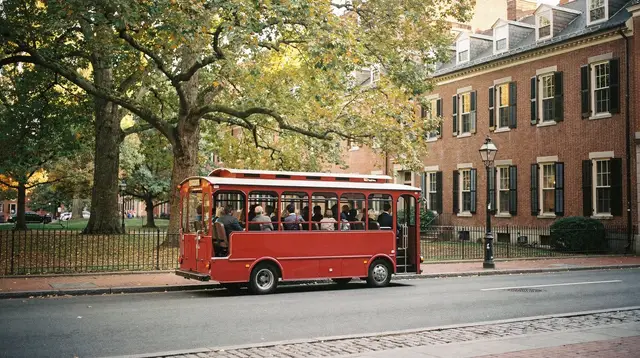
A hop-on hop-off option can also stand in for some of the walking-and-T combination on a first visit, particularly for anyone short on time or mobility.
a broader loop covering Boston’s main sights in one outingFor itinerary structures built around exactly this car-free approach, see Five days in Boston without a car or the broader planning in How many days do you need in Boston? and First-time guide to Boston. For a wider view of what to do without ever needing a car, things-to-do in Boston covers the full range of walkable and transit-reachable activities.
Getting around Boston without a car: FAQ
Is Boston really walkable, or is that overstated?
For the historic core, it holds up. Downtown Boston, the North End, Beacon Hill and Back Bay sit within about 2 to 3 kilometers (1.5 miles) of each other, connected by the Freedom Trail and ordinary sidewalks. Fenway and Cambridge are a longer walk, better done by the T.
Can I get to Cambridge and Harvard without driving?
Yes, easily. The Red Line runs directly from downtown Boston to Harvard Square and Kendall/MIT in Cambridge, usually under 20 minutes, with no parking to find on either end.
What’s the difference between the T and the Commuter Rail?
The T is the MBTA’s subway and trolley network inside Boston and the inner suburbs, paid with a CharlieCard. The Commuter Rail is a separate regional railroad with its own tickets, reaching towns like Salem, Plymouth and Providence that the T doesn’t cover.
Should I rent a car for a day trip to Salem?
Not necessary. The Commuter Rail runs from North Station to Salem in about 30 minutes, and the historic sites cluster within walking distance of the station.
When does it actually make sense to rent a car in Boston?
Mainly for outer Cape Cod towns, parts of the North Shore off the rail line, or a multi-stop New England road trip where public transit thins out. Parking in central Boston is limited and the historic streets are narrow, so a car is a liability for the city itself.
Is parking difficult in downtown Boston?
Yes. Street parking is scarce and regulated, many historic streets are one-way, and garages are the realistic option in the core neighborhoods. It’s a genuine reason to leave a car outside the city if you’re only sightseeing downtown.
Does the T run all night?
No. Service stops overnight and resumes in the morning, with the exact last-train time varying by line, so check the schedule before a late evening out.
What about getting to and from Logan Airport?
Logan is unusually close to downtown. The Silver Line SL1 runs free from the airport to South Station, and a free Massport shuttle connects each terminal to the Blue Line’s Airport station, both without needing a car.
Do I need a car to reach the Boston Harbor Islands or Cape Cod?
No. The Harbor Islands are reached by a short ferry from downtown Boston in season. Cape Cod, Martha’s Vineyard and Nantucket are a different matter logistically, but even those go by ferry from Woods Hole or Hyannis rather than requiring a car in Boston itself, though onward travel around the Cape and the islands is easier with one.
Is Bluebikes a practical way to get around instead of a car?
For short hops within the historic core and along the Charles River, yes. It’s a bike-share system, separate from the MBTA, with its own stations and pricing, and it complements walking and the T rather than replacing either for longer or cross-town trips.
Getting around Boston on GetYourGuide
Verified deep-linked GetYourGuide tours. Book through these links and we earn a small commission at no cost to you.
GetYourGuide does not provide a product photo for this activity — the image shows the meeting point, photographed by us.