Wheelchair accessibility in Boston: an honest guide
Is Boston wheelchair accessible?
Unevenly. Newer, reworked areas like the Seaport and Back Bay generally have smoother sidewalks and curb cuts, while the oldest core — Beacon Hill and parts of the North End — has brick and cobblestone paving that is genuinely hard going. The T's accessibility varies station by station, so check each stop rather than assuming the whole system is equipped the same way.
What “accessible” means in a 400-year-old city
Boston was laid out centuries before anyone designed a sidewalk with a wheelchair in mind, and it shows. Streets in the oldest neighborhoods followed old cow paths and colonial property lines rather than a grid, which is part of why Beacon Hill and parts of the North End still have narrow brick sidewalks, uneven cobblestones, and short, steep blocks. Newer or heavily rebuilt districts — the waterfront around Boston Harbor and much of Back Bay — sit on filled land from 19th-century engineering projects and generally have wider, flatter, more consistent paving with modern curb cuts.
That contrast is the single most useful thing to understand before visiting: Boston does not have one accessibility profile, it has several, and they map closely onto when each neighborhood was built or last rebuilt. This guide is a framing piece, not a station-by-station or block-by-block inventory. Where more detail exists, we link out to it rather than guessing.
We are not going to tell you a neighborhood is “totally accessible.” Sidewalk conditions change with construction, weather, and season, and what counts as manageable depends on your equipment, your assistance, and your tolerance for uneven surfaces. The honest approach is to verify specific routes and stations before you rely on them, not to trust a blanket claim from any guide, including this one.
The historic core: Beacon Hill and the North End
Beacon Hill is Boston’s most photographed residential neighborhood, with brick sidewalks, gas lamps, and steep, narrow streets running down toward the Charles River and Boston Common. Those brick sidewalks are original or close to it in many blocks, which means uneven joints, tree roots pushing up pavers, and a general lack of smooth surface. Some blocks also have a real grade, which adds another layer of difficulty beyond the paving itself.
The North End, Boston’s Italian neighborhood, has a similar profile in its oldest sections: narrow streets, older sidewalks, and blocks that were never widened for modern accessibility. It is worth visiting for the food scene around Hanover Street and the bakeries, but plan for slower, more deliberate movement than you would in a newer part of the city. Our The North End: a Boston neighborhood beyond the restaurants and North End Italian food tour guide cover the neighborhood itself in more depth.
Neither neighborhood is impossible to navigate, and neither should be avoided outright. The point is to set expectations: this is the part of Boston where the city’s age works against smooth wheelchair travel, and where planning a slower pace or an alternate route matters more than anywhere else in the city.
The Freedom Trail: a route, not a single accessible path
The Freedom Trail is a roughly 2.5-mile (4 km) walking route marked by a red line, linking 16 historic sites from Boston Common to Bunker Hill in Charlestown. Because it is a route rather than a single place, its accessibility is not one answer — it changes block by block. Some stretches run along modern, well-maintained sidewalks; others cross directly through Beacon Hill and the North End, with the paving issues described above.
We cover this in detail in a dedicated guide rather than trying to summarize every block here: see Freedom Trail accessibility for a closer look at which segments tend to be easier and which are more demanding. If you are weighing a guided walk against going at your own pace, Freedom Trail and Freedom Trail by trolley or on foot: how to choose also cover the tradeoffs, including pace control, which matters more when navigating uneven ground.
Following the red line itself costs nothing. Several of the 16 sites along the way, including the Old South Meeting House, the Old State House, and the Paul Revere House, charge their own admission and have their own building-specific accessibility, which is a separate question from the sidewalk conditions outside. Check with thefreedomtrail.org and with individual sites for current information rather than assuming either the free outdoor route or the paid indoor sites are uniformly accessible.
The T: accessible in places, not accessible as a system
The T, run by the MBTA, is Boston’s subway and light rail network, with five color-coded lines — Red, Green, Orange, Blue, and Silver. Some stations were built or renovated with elevators and level boarding; others, especially on older sections of the Green Line, predate modern accessibility requirements and were never fully retrofitted. There is no single honest sentence that describes accessibility across the whole system, because it genuinely differs from station to station.
The practical approach is to check each station you plan to use, in both directions, before you travel — an elevator listed as available does not guarantee it is working that day, and MBTA elevator outages are a known, ongoing issue rather than a rare exception. Confirm current elevator status and station-specific access on mbta.com before relying on a route, and build in a backup plan. Our The MBTA and the T: a guide to Boston’s subway explains how the system works overall, and Getting around Boston without a car covers alternatives if a planned T route turns out not to work on the day.
The Silver Line’s SL1 bus service, which connects Logan International Airport to South Station, runs on buses rather than the older rail infrastructure, which generally means more consistent accessibility than some of the oldest subway stations — but bus accessibility still depends on the specific vehicle and stop, so this is not a guarantee either. The Commuter Rail, a separate network from the T that reaches the suburbs and day-trip destinations like Salem and Plymouth, has its own station-by-station accessibility profile as well; Commuter Rail day trips from Boston covers where that network goes, though accessibility specifics should still be confirmed directly with the MBTA.
Where the newer city is easier going
If uneven historic streets are a real concern, the neighborhoods built or substantially rebuilt in the last few decades tend to offer an easier baseline. The Seaport District, on filled land along Boston Harbor, has wide modern sidewalks, newer curb cuts, and a mostly flat grid — a contrast to the historic core just across the water. Our Seaport district neighborhood guide covers the area in more detail.
Back Bay, built on filled land in the 19th century with a planned street grid, is generally more consistent than Beacon Hill, though its brownstone rowhouse blocks still have some older sidewalk sections, particularly nearer the Public Garden. Commonwealth Avenue’s central mall has a paved path that is more predictable than many nearby side streets. See Back Bay brownstones and Museum of Fine Arts Boston for what sits in this part of the city.
None of this is a substitute for checking a specific block or building. It is a general pattern — newer land, straighter streets, more consistent paving — not a guarantee for every sidewalk in these neighborhoods.
Museums, the harbor, and guided options
Boston’s major paid museums — the Museum of Fine Arts, the Museum of Science, and the Isabella Stewart Gardner Museum — are large modern institutions that generally publish accessibility information covering entrances, elevators, and restrooms, and most offer accommodations on request. Confirm current details directly with each museum before visiting, since gallery layouts, temporary exhibitions, and renovation work can change what is available on a given day. See Museum of Fine Arts Boston, Museum of Science, Boston, and Isabella Stewart Gardner Museum for what each covers.
On the water, some Boston Harbor cruise and sightseeing operators offer accessible boarding and onboard space for wheelchairs, but this depends on the specific vessel, the dock used that day, and tide conditions at some docks — it is not a blanket feature of harbor cruises as a category. We cover what to ask before booking in Accessible tours and cruises in Boston rather than listing specific boats here, since fleets and equipment change.
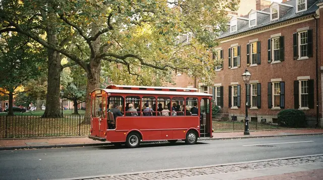
Tours built specifically with mobility needs in mind do exist in Boston, from adapted walking routes to vehicle-based sightseeing that avoids the worst paving. We are intentionally not detailing specific operators or vehicles in this guide — that level of detail lives in Accessible tours and cruises in Boston and Freedom Trail accessibility, where it can be kept current. What is worth knowing here is simply that these options exist and tend to have limited daily capacity, so booking ahead is more important than it would be for a standard tour.
A private, custom-paced tour is one practical way to work around uneven ground, since the route and pace can be set in advance with a local guide rather than following a fixed group itinerary.
a private, custom-paced Boston tour built around your own route and paceA harbor cruise along the Charles River and waterfront is another option worth checking directly with the operator for boarding details, since dock conditions vary by location.
a guided architecture and harbor cruise along the Charles RiverFor a guided walk that sticks mostly to the flatter waterfront and Seaport streets rather than the oldest brick lanes, a waterfront-focused history walk is worth asking about directly.
a guided walking tour of the waterfront and Seaport, largely on modern sidewalksPlanning around the seasons
Winter adds a layer that applies regardless of neighborhood: snow and ice accumulation on sidewalks, particularly in the narrower streets of Beacon Hill and the North End where clearing is slower and less consistent than on wider modern sidewalks. If you are visiting between December and February, build extra buffer time into any walking route and check conditions the morning of, since a clear sidewalk after a storm is not guaranteed on a fixed schedule. Our Boston in winter covers the season more broadly.
Fall, when Boston is at its most visited for foliage, brings heavier foot traffic on already-narrow historic sidewalks, which can make navigating a wheelchair through crowded blocks in Beacon Hill or the North End slower than at quieter times of year. This is a crowding issue rather than a surface issue, but it is worth factoring in alongside the paving itself.
Beyond the city itself
If your trip extends beyond Boston to day trips, accessibility questions apply differently in each place. Salem’s downtown historic district has some of the same brick-and-cobblestone character as Beacon Hill, and gets significantly more crowded in October during Haunted Happenings, which compounds any mobility difficulty. Cambridge, across the Charles River and home to Harvard and MIT, mixes older campus paths with newer university buildings and generally has wider modern sidewalks around Harvard Square itself. Newer coastal areas like Newport’s waterfront tend to follow the same newer-is-flatter pattern as Boston’s own Seaport.
We are not covering those destinations’ accessibility in detail here — this guide is about Boston itself. The point is simply that “check station by station, block by block” is not unique to Boston’s downtown; it is a reasonable default for most of New England’s older towns.
The honest bottom line
There is no single accurate answer to “is Boston wheelchair accessible” beyond “it depends on exactly where you’re going, and you should check before you rely on a route.” The newer parts of the city — the Seaport, most of Back Bay — offer a genuinely easier baseline than the 17th- and 18th-century streets of Beacon Hill and the North End. The T has real accessible stations, and it also has real gaps and elevator outages that a generic claim would paper over. The Freedom Trail is walkable in sections and difficult in others, on the same 2.5-mile route.
None of that makes Boston a poor choice for a wheelchair user. It makes it a city where planning ahead — checking specific stations on mbta.com, calling ahead to museums and tour operators, and building slower routes through the oldest neighborhoods — does more good than any general reassurance could. Start with Freedom Trail accessibility and Accessible tours and cruises in Boston for the two areas where the detail matters most, and The MBTA and the T: a guide to Boston’s subway for how to move around the rest of the city day to day.
Frequently asked questions about wheelchair accessibility in Boston
Is the Freedom Trail wheelchair accessible?
Parts of it are manageable, but not the whole route. Some stretches run over brick sidewalks and cobblestones, particularly around Beacon Hill and the North End, that are difficult for wheelchair users. See our dedicated freedom-trail-accessibility-guide for a section-by-section read.
Which T lines have accessible stations?
All five T lines have some accessible stations, but coverage is inconsistent, especially on the older sections of the Green Line, which was built long before modern accessibility standards. Check each station individually on mbta.com before you plan a route, rather than assuming a line is accessible end to end.
Are Boston sidewalks generally wheelchair-friendly?
It depends heavily on the neighborhood. Newer or rebuilt areas such as the Seaport waterfront and Back Bay tend to have flatter, wider sidewalks with curb cuts. The oldest parts of the city, especially Beacon Hill, still have narrow brick sidewalks, uneven paving, and steep short blocks.
Are museums in Boston accessible?
Most major museums, including the Museum of Fine Arts, the Museum of Science, and the Isabella Stewart Gardner Museum, publish accessibility information and generally offer accessible entrances, elevators, and restrooms. Always confirm current details directly with the museum before visiting, since routes and construction can change.
Can wheelchair users take a Boston Harbor cruise?
Some harbor cruise and sightseeing boat operators offer accessible boarding, but this varies by vessel and by dock, and not every boat can accommodate a wheelchair. See accessible-tours-and-cruises-boston for what to check before booking.
Is public transit in Boston reliable for wheelchair users?
The T covers a lot of the city, but service gaps, station-specific elevators, and older infrastructure on some lines mean it is not uniformly reliable for wheelchair users. Our mbta-the-t-guide covers how the system works in general; for accessibility specifically, confirm each station you plan to use.
Should I book accessible tours in advance?
Yes. Wheelchair-accessible vehicles, boats, and guided tours are a limited subset of what is offered in Boston, and they can sell out or have limited daily availability, so booking ahead is safer than arriving and hoping to find an accessible option on the spot.
Accessible tours in Boston on GetYourGuide
Verified deep-linked GetYourGuide tours. Book through these links and we earn a small commission at no cost to you.
GetYourGuide does not provide a product photo for this activity — the image shows the meeting point, photographed by us.