Is the Freedom Trail worth following to the end?
The Old North Church is not where I expected to stop walking.
I had started, like most people do, at Boston Common, following the double row of red brick set into the sidewalk that marks the Freedom Trail. The line is easy to follow and, for a while, satisfying in the way a well-marked trail always is: you don’t have to think, you just walk, and history arrives in order. Boston Common gives way to the Massachusetts State House, then down into the tighter streets around Beacon Hill, and eventually to the Granary Burying Ground, which is the first place the trail actually stopped me rather than just moving me along.
The Granary is squeezed between two office buildings on Tremont Street, close enough that you can see reflected glass over the gravestones if you look up. Paul Revere is buried there, and Samuel Adams, and the parents of Benjamin Franklin, among a few thousand others whose names have mostly worn off their slate markers. What struck me wasn’t the roster of famous burials but the compression of it — a colonial cemetery with almost no buffer from a modern financial district, cars idling at the light a few feet from the fence. The trail doesn’t editorialize about that juxtaposition. It just runs the red line past it and lets you notice, or not.
I noticed. And that noticing is, I think, the real argument for walking any of the trail at all: not the facts at each marker, which you can read for free without leaving home, but the way the line forces you to stand in a spot instead of driving past it or scrolling past a photo of it.
Where the line starts to feel like a leash
The trouble started for me around Faneuil Hall. That stretch of the route is where Boston’s marketing muscle is most visible — costumed guides gathering tour groups, souvenir carts, the kind of concentrated foot traffic that makes the historical markers compete with people selling magnets shaped like the state of Massachusetts. None of that is dishonest, exactly. It’s a city monetizing its own history, which cities do everywhere. But it’s a different register than the Granary, and the trail doesn’t distinguish between the two. It just keeps painting the line, indifferent to whether you’re standing somewhere solemn or somewhere that has been fully converted into a retail experience.
That’s the first honest counterargument to everything I’m about to say: the line exists precisely because Boston’s revolutionary history is scattered and dense, spread across four centuries of construction on top of construction, and without a marked route most visitors would never piece it together. I’ve talked to people who credit the Freedom Trail with the entire reason they understood Boston at all — without it, they say, they would have seen a handful of old buildings and missed how they connect. That’s a real service, and I don’t think the trail deserves to be dismissed as a tourist gimmick. It’s closer to a very literal table of contents for a story that would otherwise be illegible on foot.
Still, a table of contents is not the book, and somewhere past Faneuil Hall I started to feel like I was reading captions instead of a city.
The North End breaks the spell, on purpose
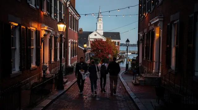
The trail’s route into the North End is one of its better sequencing decisions, whether intentional or not. You leave the crowded plaza around Faneuil Hall and the line threads into Boston’s Italian neighborhood, where the Old North Church rises white and colonial in the middle of streets that otherwise smell like garlic and espresso. The building is genuinely striking precisely because it doesn’t belong to its surroundings anymore — it’s a Georgian steeple standing over a neighborhood shaped by nineteenth- and twentieth-century Italian immigration, not eighteenth-century Congregationalists. The trail’s red line runs directly past a cannoli shop on its way to a lantern-signal church, and nobody comments on it, which is somehow more honest than if they did.
This is where I first left the line. Not out of protest, just curiosity — I wandered two blocks off the marked route to find a bakery, came back twenty minutes later, and picked the trail up again without having missed anything essential. That small detour is, in miniature, the whole argument of this piece: the trail works better as a spine than as a leash. It tells you where the story lives. It doesn’t require you to follow it with your eyes down.
Where the crowd thins, and what that does to a walk
After the North End, the trail crosses the bridge toward Charlestown, and this is where something changes that I didn’t expect. The crowd, which had been dense and constant since Boston Common, thins out almost immediately on the far side of the water. Fewer costumed guides, fewer group tours, fewer people stopping to take the same photo everyone else is taking. By the time the line climbs toward Bunker Hill, you’re mostly walking alone, or with the handful of people who decided the full distance was worth it.
I liked this part better, and I think the reason is structural rather than sentimental. Charlestown isn’t staged the way the blocks around Faneuil Hall are. There’s less to sell there, so less has been built to sell it. The obelisk on Bunker Hill is plain, the surrounding streets residential, and the walk over to the Charlestown Navy Yard feels like arriving somewhere rather than completing a checklist. It’s the moment the trail earns the word “trail” instead of “tour.”
But it’s also, honestly, the point at which I’d already gotten what I wanted from the day, and I know plenty of visitors turn back before this stretch, tired from the earlier crowds and satisfied with what they’ve already seen downtown.
Where the red line stops meaning anything
There’s a specific, almost comic moment on the Freedom Trail where the painted line crosses an ordinary commercial crosswalk — bank branch on one corner, a phone-repair shop on another — and for a few seconds the red brick sits there next to delivery trucks and pedestrians who have no idea a historic route runs under their feet. It’s not a failure of the trail. It’s just a reminder that the line is drawn over a living, working city, not a preserved diorama. Boston keeps functioning underneath its own reenactment.
That tension — between the Granary’s genuine gravity and the crosswalk’s total indifference, between the self-guided version of the walk and the version led by a costumed narrator, between authentic site and souvenir shop grafted onto it — is, to me, the actual subject of the Freedom Trail, more than any single stop on it. I don’t think the answer is to skip it, and I don’t think the answer is to treat it as sacred either. A walking tour through the Beacon Hill end of the route, or a slower pass through Charlestown on its own, can tell you as much as the full line does, sometimes more, because you’re not rationing your attention across four kilometers.
If you do want company and context for at least part of it, a small-group walking tour along the Freedom Trail’s marked route or the official guided tour run along the Freedom Trail will fill in the parts a self-guided pass can skip past too quickly. And if the trip extends past the city — some visitors fold Boston into a longer swing north — there’s also a day that combines the Freedom Trail with Salem, Rockport, and Cape Cod for anyone who wants the trail as a starting point rather than the whole day.
I still think the honest version of this essay ends where I did: at the Old North Church, cannoli in hand, having decided that the rest of the line — Charlestown, Bunker Hill, the Navy Yard — could wait for another visit, or another version of me who wanted the full distance more than I did that afternoon. The comparison between following the line yourself and joining a guided version of it matters less than whether you let yourself stop where the city, not the paint, tells you to.
Freedom Trail questions I keep getting asked
Is the Freedom Trail free to walk?
Following the painted red line costs nothing. Some of the 16 sites it links, including a few historic buildings, charge their own admission, while others are free or open on donation, so it varies stop by stop.
Is the Freedom Trail one place or a route through several neighborhoods?
It is a route, not a single site or museum. The line runs roughly 2.5 miles (4 km) from Boston Common through downtown and the North End into Charlestown, crossing several neighborhoods with very different characters.
Do I have to walk the whole Freedom Trail in one go?
No. The line is continuous on the ground, but nothing obliges anyone to walk it start to finish in a single outing, and stopping partway is a legitimate way to experience it.
Why does the Freedom Trail feel more touristy in some sections than others?
Density of foot traffic and commercial activity varies a lot along the route. Sections near Faneuil Hall and the North End see heavier crowds and more souvenir shops than the quieter stretch toward Charlestown and Bunker Hill.
Are the costumed guides on the Freedom Trail actors or historians?
Costumed guides on independently run walking tours are performers as much as narrators, presenting history through character and anecdote rather than strict lecture, which is a different experience than reading the trail’s own markers.
Is Cambridge or Harvard part of the Freedom Trail?
No. The Freedom Trail stays within Boston and Charlestown. Harvard and MIT are across the Charles River in Cambridge, a separate city with no connection to the trail’s route.
tours.Landmarks Reconsidered
Verified deep-linked GetYourGuide tours. Book through these links and we earn a small commission at no cost to you.
GetYourGuide does not provide a product photo for this activity — the image shows the meeting point, photographed by us.