Freedom Trail accessibility: what the surface is really like
Is the Freedom Trail wheelchair or stroller accessible?
Not evenly. The route mixes smooth modern sidewalks with old brick and cobblestone sections, mainly in the North End and Beacon Hill, plus a slope near Bunker Hill in Charlestown. Most visitors with mobility needs do best picking specific sections rather than the full 4-kilometer route in one go.
What “accessible” actually means on this route
The Freedom Trail is not a single site with a ramp or a lack of one. It is a roughly 4-kilometer marked route connecting 16 historic sites, from Boston Common to Bunker Hill in Charlestown, crossing several neighborhoods with very different sidewalks along the way. That matters for accessibility planning: there is no single yes-or-no answer, and no official accessibility rating covers the entire line at once. What follows is a section-by-section account of the surface conditions, written for anyone using a wheelchair, a mobility scooter, a stroller, or simply someone who finds cobblestone and long walks difficult.
This is not a substitute for checking current conditions before a visit. Sidewalk repairs, construction, and seasonal maintenance change from one month to the next, and the thefreedomtrail.org website is the place to confirm anything time-sensitive.
Boston Common and downtown: the easier start
The trail begins at Boston Common, the oldest public park in the country, which is free to enter and has paved paths that are generally level and well maintained. The stretch through the Common and into the immediate downtown area, past the Massachusetts State House and toward the Old Granary Burying Ground, runs mostly along standard city sidewalks. These are not perfect — curb cuts vary in quality, and some blocks near government buildings have uneven paving from utility work — but this is, on the whole, the most manageable part of the route.
This makes the downtown segment a reasonable place to start if you are testing how the day feels before committing to more.
The North End: brick, narrow sidewalks, and real unevenness
Once the trail crosses into the North End, the surface changes noticeably. This is Boston’s Italian neighborhood, with some of the oldest streets in the city, and the sidewalks reflect that age: sections of brick paving that have shifted with decades of freeze-thaw cycles, narrow stretches where two wheelchairs could not easily pass, and occasional gaps between paving stones. The route past Old North Church and toward Paul Revere House sits directly in this zone.
None of this makes the North End impassable. It does mean slower, more careful movement, and it is worth building in extra time if bakery stops at places like Mike’s Pastry are part of the plan anyway.
Beacon Hill: the same story, on a different kind of hill
Beacon Hill is not directly on the main Freedom Trail line for most of its length, but the trail’s route near the State House and toward the start of the walk shares the neighborhood’s character: brick sidewalks, historic gas lamps, and a general lack of modern paving standards. Some of the most photographed streets in this neighborhood, including Acorn Street, are deliberately preserved as they were built, which means original cobblestone rather than anything resurfaced for foot traffic.
If Beacon Hill’s cobblestone streets specifically are part of your plan, treat them as a separate stop to approach at a slow pace, not as a quick pass-through on the way to the next Freedom Trail site.
Charlestown and the approach to Bunker Hill
At the far end of the trail, past the Charlestown Navy Yard and the USS Constitution, the route climbs toward the Bunker Hill Monument. This is the one place on the trail with a clear, sustained slope rather than just uneven paving. Combined with the distance already covered by this point — Bunker Hill sits at the far end of the route from Boston Common — this stretch is often the hardest part of the day for anyone with limited stamina or mobility, independent of wheelchair use specifically.
The Charlestown Navy Yard itself, and boarding the USS Constitution, involves flatter ground and is more manageable than the walk up to the monument.
A section-by-section approach works better than the full trail
Given this mix of surfaces, most visitors with mobility needs are better served treating the Freedom Trail as several separate outings rather than one continuous 4-kilometer walk. A few ways this plays out in practice:
- Cover downtown and Boston Common on one visit, where the sidewalks are most consistent.
- Treat the North End as its own trip, ideally combined with a meal, so the pace is naturally slower.
- Decide in advance whether Bunker Hill is worth the climb for your group, rather than assuming it has to be the finish line.
- Skip or shorten any section where the pavement description above matches a known problem area for you.
This is not a compromise on seeing the city — it is closer to how many visitors experience Boston’s older neighborhoods anyway, on foot, in pieces, over more than one day.
| Section | General surface | Main concern |
|---|---|---|
| Boston Common to downtown | Paved paths, standard sidewalks | Occasional construction, uneven curb cuts |
| North End | Brick, narrow in places | Shifted paving, tight sidewalks |
| Beacon Hill streets | Brick and historic cobblestone | Original, uneven cobblestone by design |
| Charlestown to Bunker Hill | Mixed paving plus a slope | Sustained incline near the monument |
Guided pacing versus going it alone
A guide who knows the route can help set a realistic order and pace for the sections you choose, including where to plan a break before tackling a harder stretch. The Historic Pub Crawl Tour Along the Freedom Trail is one option that breaks the walk into stops with built-in pauses rather than a straight march from one end to the other, via a guided pub crawl that follows the Freedom Trail in stages. For a more traditional historical walk with a guide setting the pace, a guided walk along Boston’s revolutionary-era sites covers much of the same ground with someone managing timing and rest stops.
For a deeper dive into the North End specifically, where the surface challenges are greatest but the food and history are hard to skip, a Freedom Trail tour that includes the North End pairs the walk with context on the neighborhood. And for a lighter, social framing of the same route, a guided walk hitting the trail’s best-known stops is built around shorter stretches between stops rather than a continuous walk.
See Freedom Trail: guided versus self-guided for more on how pacing differs between the two approaches, whether or not accessibility is a factor.
Getting to the start without a car
Most people begin at Boston Common, and the easiest way there is the T, the MBTA’s subway network. The Green Line and Red Line both stop at Park Street, right at the edge of the Common, which avoids a long walk before the accessibility questions above even come into play. A CharlieCard is the standard way to pay, and a single ride includes transfers within a set window, though the exact fare is worth checking on mbta.com since it changes over time. One planning detail that matters for an early or late start: the T does not run 24 hours a day, so a very early morning or late evening visit needs a taxi, rideshare, or a walk instead. See the MBTA guide for how the lines fit together, and getting around Boston without a car for the wider picture beyond the subway.
If the plan is to end the day near Charlestown after the Bunker Hill climb, it is worth checking return options before setting out rather than after a long walk, since the Navy Yard area is not served the same way as downtown.
Weather, season, and surface conditions
None of the surface descriptions above are fixed. Brick and cobblestone that are merely uneven in dry weather become genuinely slippery with rain, and New England winters bring ice and packed snow that sit on top of already irregular paving for weeks at a time. Anyone planning a Freedom Trail visit around accessibility should treat winter as a separate case from the rest of the year, not a smaller version of the same walk. Fall brings its own complication: the season when New England’s foliage draws the largest crowds overlaps with some of the more comfortable walking weather, so the trade-off is smoother footing against denser sidewalks in the North End and downtown. See the Boston in winter guide and best time to visit Boston for how the seasons compare more broadly.
One date is worth flagging specifically: Patriots’ Day, the third Monday in April, is also Boston Marathon day, and the route and crowds that come with it can affect movement through parts of downtown near the start of the trail. It is covered in more detail in the Boston Marathon and spring guide.
The trolley as a motorized alternative
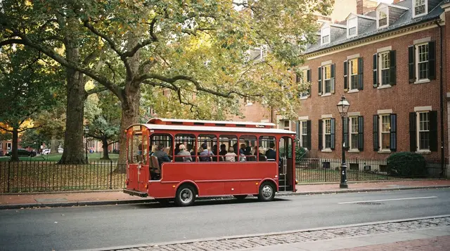
For sections where walking is not realistic — the Bunker Hill approach, or the full distance between downtown and Charlestown — a hop-on hop-off trolley is worth considering. It does not follow the exact Freedom Trail line, and it will not put you inside the North End’s narrow streets, but it removes the walking requirement for the connections between neighborhoods. See Trolley versus walking in Boston for how the two compare on this specific route, and Boston hop-on hop-off guide for how the trolley network is set up.
What this guide does not promise
This page does not claim the Freedom Trail is fully wheelchair accessible, because it is not, evenly, along its whole length. It does not give an exact grade percentage for the Bunker Hill slope or a precise distance for each section, because those figures are not something this site tracks reliably enough to state as fact. And it does not recommend one specific alternate route around the roughest sidewalks, because conditions change with construction and season, and a route invented here could be wrong by the time you walk it. What it does offer is a realistic picture of where the friction actually is, so the planning decision is yours to make with accurate information.
Fitting this into a shorter visit
Not everyone has the luxury of spreading the Freedom Trail across several outings. For a first visit with limited time, the Walking the Freedom Trail on your own: a self-guided route covers how to prioritize sites without a guide setting the pace, which pairs naturally with the section-by-section approach described above. If accessibility needs are the main planning constraint for the whole trip rather than just this one route, the wheelchair-accessible Boston itinerary builds a full day around manageable surfaces and transit connections rather than retrofitting one onto a standard plan. For a one-day version of the trail itself, Freedom Trail: one-day walking lays out a route order, and it is worth adapting against the surface notes above rather than following it exactly if mobility is a factor.
More generally, how many days in Boston and first time in Boston both address how the Freedom Trail fits alongside the rest of the city’s attractions, which matters if the goal is to budget an extra day specifically so the trail does not have to be rushed.
Beyond the Freedom Trail
Mobility considerations extend well past this one route. The wheelchair-accessible Boston guide covers the T, major museums, and other attractions across the city, and is the better starting point if the Freedom Trail is only one piece of a longer visit. For general orientation on the trail’s 16 sites and what each one costs to enter, see the Freedom Trail guide.
Freedom Trail accessibility: questions worth asking before you go
Is the whole Freedom Trail wheelchair accessible?
No single answer covers the full route. Sections near Boston Common and some of the newer sidewalks downtown are relatively smooth, while stretches through the North End and Beacon Hill run over old brick and uneven cobblestone. Treat the trail as a series of separate sections rather than one continuous accessible path.
Which parts of the Freedom Trail have the roughest surface?
The North End and Beacon Hill have the oldest sidewalks on the route, with brick paving that has shifted and cracked over time. These are also the most visually rewarding sections, so the tradeoff between surface quality and historic character is real, not a formality.
Is there a slope or hill on the route?
Yes, toward Bunker Hill in Charlestown, at the far end of the trail. The approach to the Bunker Hill Monument involves a noticeable rise, on top of surfaces that are not uniformly smooth.
Do I have to walk the entire 4-kilometer trail?
No. The Freedom Trail is a marked route linking 16 sites, not a single attraction, and nothing requires walking it end to end in one outing. Many visitors cover it in sections over more than one day, or skip stretches that don’t suit their mobility needs.
Is following the red line itself free, regardless of accessibility?
Yes. Following the painted or brick line on the ground costs nothing from Boston Common to Bunker Hill. Some of the 16 sites along the way sell their own tickets; that is separate from the cost of walking the route.
Are there alternatives to walking the whole trail?
A guided tour can help set a realistic pace and route order for the sections you choose to cover on foot. A trolley tour is a motorized alternative worth considering for the harder stretches, though it follows its own route rather than the exact Freedom Trail line.
Where can I check accessibility for the wider city, not just the trail?
See the city-wide accessibility guide, which covers the T, museums, and other Boston attractions beyond the Freedom Trail itself.
Accessible tours in Boston on GetYourGuide
Verified deep-linked GetYourGuide tours. Book through these links and we earn a small commission at no cost to you.
GetYourGuide does not provide a product photo for this activity — the image shows the meeting point, photographed by us.