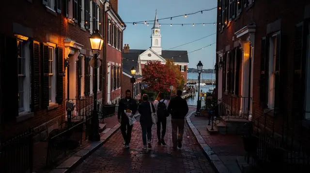
The Freedom Trail is not a place. It’s a route: a 2.5-mile (4 km) line of red brick, or in some stretches painted red paint, set into the sidewalk and connecting 16 sites tied to the American Revolution. It starts at Boston Common and ends at the Bunker Hill Monument in Charlestown, and the whole thing can be walked in one continuous stretch without ever needing a bus, the T or a car between stops. Most visitors don’t do that. They walk part of it, peel off for lunch or a museum, and come back to it later, if at all.
What the trail actually covers
The 16 sites are strung out roughly north from the Common: Boston Common itself, the Massachusetts State House, Park Street Church, the Granary Burying Ground, King’s Chapel and its burying ground, the site of the first public school and Benjamin Franklin’s statue, the Old Corner Bookstore, the Old South Meeting House, the Old State House, the site of the Boston Massacre, Faneuil Hall, the Paul Revere House, the Old North Church, Copp’s Hill Burying Ground, the USS Constitution at the Charlestown Navy Yard, and finally the Bunker Hill Monument.
That’s a lot of ground and a lot of centuries in one walk. The early stretch, through the Common and past the State House, is 18th-century civic Boston. The middle stretch, around Faneuil Hall and into the North End, is where merchants, mobs and printers operated. The final stretch crosses the Charlestown Bridge into a different physical landscape entirely — a working Navy yard and a granite obelisk on a hill.
How long it actually takes
Walking the full 4 km at a normal pace, without stopping, takes a bit over an hour. Nobody does it that way. Budget 2 to 4 hours if you’re walking the whole thing and popping into two or three sites along the way. If you want to go inside every paid site with any care — reading exhibits, not just photographing facades — treat it as a half-day minimum, closer to a full day if you’re also stopping for lunch in the North End or a proper look at Faneuil Hall’s upstairs meeting room.
Realistically, most first-time visitors do the trail in sections. A common split: Boston Common to Faneuil Hall in the morning, the North End and Old North Church around lunch, then either continue to Charlestown or save the Navy Yard and Bunker Hill for a separate outing, since that leg adds real distance and a bridge crossing.
Where to start
Both ends of the trail are reachable by the T. For the Boston Common start, take the Red or Green Line to Park Street station — you’ll come up steps from the platform onto the Common itself, with the trail’s red line visible nearby. For a start closer to the middle of the route, Government Center station (Blue or Green Line) puts you a short walk from Faneuil Hall. There’s no fee to follow the trail from either starting point; you just find the brick line and go.
What’s free and what isn’t
Following the red line costs nothing, start to finish. What varies is the 16 individual sites along it. The Old State House and the Paul Revere House both charge admission — figure on a modest per-adult fee at each, though exact pricing changes and is worth checking before you go rather than assuming a number here. The Old South Meeting House also typically charges. On the other side, the burying grounds (Granary, King’s Chapel, Copp’s Hill), the Common, and Faneuil Hall’s main hall are free to enter.
The Old North Church has historically charged a modest fee for the sanctuary and crypt, though its courtyard is open. The USS Constitution itself is free to board — a working US Navy vessel, with ID required for adults and a security check at the gate — while the adjacent USS Constitution Museum runs on a suggested donation rather than a mandatory ticket. Don’t take any of these as fixed prices; check the site’s own page before you go, since these numbers move year to year.
Several sites along the route, including some managed under the Boston National Historical Park umbrella by the National Park Service, may also run seasonal ranger talks or limited free-entry windows — worth checking on arrival rather than assuming.
Crowds and timing
The trail is busiest in summer and during school vacation weeks, when the narrow sidewalks around Faneuil Hall and the Old State House genuinely bottleneck. It’s walkable in any weather and at any time of year — the brick line doesn’t close — but summer heat and humidity make the full 4 km considerably less pleasant than a cool fall or spring morning. If you’re set on walking the whole route in one go, an early start beats an afternoon start, both for crowds and for temperature.
Walking it yourself versus a trolley or hop-on hop-off bus
The Freedom Trail is a pedestrian route, not a driving route — several of its best stretches, through the Common and the narrow lanes of the North End, aren’t accessible to any vehicle. That said, plenty of visitors pair the walk with a hop-on hop-off trolley for the rest of the city, using the bus to cover ground between neighborhoods and their own feet for the trail itself. If you’re trying to decide how much of the 4 km to cover on foot versus by wheels, there’s a dedicated comparison at trolley versus walking the Freedom Trail, and a broader look at trolleys versus walking Boston as a whole, beyond just this one route. Neither option is wrong; a trolley pass makes more sense if you’re also using it to reach Fenway or Back Bay the same day, while walkers save the trolley budget and get a slower, more detailed look at each block.
Continuing the Revolutionary story beyond Boston
The Freedom Trail covers the events that happened inside the city, but the fighting that opened the Revolutionary War started outside it. Lexington and Concord, less than an hour from Boston, mark the site of the war’s first shots along the Battle Road, and a growing number of visitors treat the Freedom Trail and a Lexington-Concord outing as two halves of the same story rather than separate trips. There’s a dedicated route guide at the Battle Road through Lexington and Concord, and a practical Lexington and Concord day trip guide covering transport and timing from the city. Neither site requires advance booking to simply walk the grounds, and both pair naturally with a morning spent on the Freedom Trail’s early Revolutionary sites around the State House and Old South Meeting House.
What’s next to the trail, not on it
Three parts of this site connect directly to specific stretches of the Freedom Trail. Right after the Old North Church, the trail effectively runs through the edge of the North End — Boston’s Italian neighborhood, and a natural place to break for lunch given the concentration of bakeries and restaurants a block or two off the marked route. At the start of the trail, the Massachusetts State House sits at the edge of Beacon Hill, the brick-and-gas-lamp residential neighborhood just north of the Common — worth a short detour even though it isn’t one of the 16 marked stops. And at the far end, the Charlestown Navy Yard where the USS Constitution is berthed looks directly out onto Boston Harbor, so if you’re already at the Navy Yard, it’s a reasonable spot to consider a harbor cruise or a look at the working waterfront.
Guided versus self-guided
You can walk the entire trail with nothing but the red line and a map — it’s designed to be self-explanatory, and every site has some form of on-site signage. A guided walk adds historical narrative and context that the brick line alone doesn’t provide, plus a guide who can answer questions and manage pacing through the busiest stretches. One option covering the core route is a guided walk along Boston’s Revolutionary Path, and for a version that folds in the North End afterward, there’s a Freedom Trail tour paired with the historic North End.
If straight Revolutionary history isn’t the only thing you’re after, Boston also has an active line of walking tours built around its darker or stranger corners — a walking tour covering the city’s ghosts, pirates and politicians runs through some of the same downtown streets from a different angle, and for a lighter, more irreverent take on the city’s academic side rather than the trail itself, there’s a tour poking fun at Boston’s Harvard obsession.
Practical tips for walking it
Wear shoes you’ve already broken in — the route is entirely on sidewalks and a couple of brick or cobblestone stretches, and 4 km adds up faster than it sounds once you factor in backtracking to find the red line where it fades at a few intersections. Public bathrooms are limited along the route itself; the visitor centers at Boston Common and Faneuil Hall are the most reliable stops, and several of the paid sites let you use their facilities even if you’re not touring the exhibit.
Water is easy to find in the busier stretches near Faneuil Hall and the North End, less so once you’re past Copp’s Hill heading toward Charlestown, so it’s worth carrying a bottle for the final leg. If you’re combining the walk with a first visit to the city more broadly, the one-day Freedom Trail walking itinerary lays out a full schedule start to finish, and the two-day Boston highlights itinerary or the more complete three-day first-time Boston itinerary both build the trail in as one piece of a longer visit rather than the whole trip.
What the trail is not
Worth saying plainly, because it’s a common mix-up: the Freedom Trail is not a single site, a museum or a neighborhood. It’s a route through several different areas of the city — downtown civic Boston, the North End, and Charlestown — connected by a painted or bricked line and nothing else. It also has nothing to do with Cambridge, Harvard or MIT, which sit across the Charles River in a separate city entirely, or with Cape Cod and the islands, which are hours away by ferry. If a guide or itinerary describes the Freedom Trail as a place you visit rather than a path you walk, that’s a sign it wasn’t written with much care.
Freedom Trail: frequently asked questions
Is walking the Freedom Trail free?
Following the red brick line from site to site costs nothing. Several of the 16 individual sites along the way — including the Old State House and the Paul Revere House — charge their own admission fee; others, like the burying grounds and Faneuil Hall’s main hall, are free to enter.
How long does the Freedom Trail take to walk?
The full 2.5-mile (4 km) route takes a bit over an hour of pure walking, but most visitors spend 2 to 4 hours covering it with stops, and a full day if visiting every paid site along the way in detail.
Where does the Freedom Trail start and end?
It starts at Boston Common, reachable by Red or Green Line to Park Street station, and ends at the Bunker Hill Monument in Charlestown, near the Charlestown Navy Yard where the USS Constitution is berthed.
Do I need to walk the whole Freedom Trail in one go?
No. Most visitors split it into sections, commonly walking downtown to the North End in one outing and saving the Charlestown leg — which adds a bridge crossing and more distance — for a separate visit.
Is the USS Constitution part of the Freedom Trail free to visit?
Boarding the USS Constitution itself is free, though adults need photo ID and pass through a security check. The adjacent USS Constitution Museum operates on a suggested donation rather than a fixed admission price.
Is Cambridge on the Freedom Trail?
No. Cambridge, home to Harvard and MIT, is a separate city across the Charles River and isn’t part of the Freedom Trail route at all.
What’s the best time of year to walk the Freedom Trail?
Spring and fall offer the most comfortable walking temperatures. Summer is busiest and can be hot and humid for a 4 km walk with limited shade along several stretches.
Can I combine the Freedom Trail with the North End in one day?
Yes, and it’s a common pairing. The trail runs directly past the Old North Church at the edge of the North End, making it an easy lunch or afternoon stop before continuing on toward Charlestown.
Should I walk the Freedom Trail on my own or join a tour?
Both work. The trail is fully self-explanatory with on-site signage at every stop, and a self-guided walk costs nothing beyond your own time. A guided option adds narrative context and a set pace; the trade-offs are laid out in more detail in guided versus self-guided.
Is the Freedom Trail connected to Lexington and Concord?
Not physically — the marked red line stays inside Boston and Charlestown. But historically the two are closely tied: the Freedom Trail covers the buildup to the Revolution inside the city, while Lexington and Concord mark where the fighting actually began, less than an hour away.