Boston’s waterfront isn’t one thing. It’s a working stretch of piers, a rebuilt neighborhood of glass and concrete, and a scatter of islands you can only reach part of the year. Getting the three straight saves a wasted trip: the Seaport is a Boston neighborhood you can visit any day of the year, while the Boston Harbor Islands are a separate, seasonal destination that requires a ferry ticket and a check of the calendar first.
The Seaport: what’s actually there
The Seaport District sits on filled land south of Fort Point Channel, across the water from downtown. Twenty years ago it was parking lots and warehouses; today it’s the fastest-changing part of the city, with glass office towers, hotel chains, and a restaurant scene that skews expensive even by Boston standards. It’s not historic — that’s the point of the contrast with the North End and the Freedom Trail a short walk north.
The Institute of Contemporary Art (ICA Boston) anchors the neighborhood’s cultural side, cantilevered out over the water on Fan Pier. It’s a ticketed museum (adult admission runs in the range of $20-25; check ica.org for the current price and any free-admission hours) and worth the detour if contemporary art interests you — it’s not part of the Freedom Trail circuit and doesn’t try to be.
Beyond the ICA, the Seaport is mostly about eating and walking. Seafood restaurants line the water, several with outdoor seating in summer; prices here run noticeably higher than the North End or Chinatown, and it’s fair to call some of it overpriced for what you get on the plate. If clam chowder and lobster rolls are the goal rather than a view, the North End and Quincy Market generally deliver more food for the money.
Long Wharf and the ferries
Long Wharf, on the downtown side of the harbor near the New England Aquarium, is where the boats leave from — not the Seaport. This distinction trips people up: a hotel in the Seaport doesn’t put you next to the ferry dock, and a ferry ticket for Long Wharf doesn’t mean a walk from the ICA.
From Long Wharf, seasonal ferries run to the Boston Harbor Islands, and separate excursion boats run harbor cruises, sunset cruises and whale-watching trips. All of these are weather- and season-dependent; none of them run on a fixed year-round schedule, and none of them should be booked as an afternoon-of decision in shoulder season without checking that day’s departures first.
A harbor cruise that circles the inner harbor at sunset is one of the more reliable ways to see the skyline and the islands from the water without committing to a full island day:
a sunset cruise around Boston HarborThe Boston Harbor Islands
Boston Harbor Islands is a National and State Park spread across more than 30 islands and peninsulas in the harbor, jointly managed by the National Park Service and the state. Only a handful of the islands have regular visitor access, and which ones are open changes by season — don’t assume a given island is reachable without checking bostonharborislands.org for the current year’s schedule.
The ferry from Long Wharf to the park’s hub islands runs seasonally, generally from late May to early October, with reduced service at the edges of that window and effectively none in winter. This is the single most common mistake in trip planning for the harbor: booking a February visit expecting island access that simply isn’t operating. If the islands are the goal, the trip has to be built around the season, not the other way around.
Once out there, the islands offer swimming beaches, walking trails, a Civil War-era fort on Georges Island, and camping on a couple of islands in summer (permit required). There’s no food service to count on beyond a snack bar on the main hub island in season, so most visitors bring their own.
A ferry-and-islands outing is the straightforward way to do this without renting a boat:
a Boston Harbor Islands ferryWhale watching from the harbor
Whale-watching boats also leave from this stretch of waterfront, generally from April to October, heading well offshore to the Stellwagen Bank National Marine Sanctuary, a feeding ground in the Gulf of Maine roughly 25 miles (40 km) out. This is open-ocean water, not the harbor itself, and trips run several hours round-trip — expect a half-day commitment, seasickness risk on a rough day, and no guarantee of sightings, since these are wild animals in open water, not a marine park. Outside the April-to-October window, whale-watching trips from Boston generally don’t run at all.
Cape Cod, covered separately on this site, is another launch point for whale watching later in the season and is worth comparing if the Boston departures don’t fit the itinerary — see Cape Cod for that option.
The Harborwalk
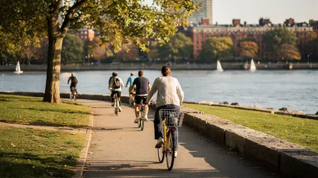
The Harborwalk is a pedestrian route, not a single park — a chain of public walkways along the water’s edge that, where complete, lets you walk continuously from the North End past the downtown waterfront and into the Seaport without leaving the water’s edge. It isn’t finished everywhere; some stretches detour inland around private developments, and signage varies by segment. It’s free, open year-round, and doesn’t require any ticket or reservation — the most reliable, no-planning way to see the harbor if the ferries aren’t running or aren’t in the budget.
Walking the Harborwalk from the North End to the Seaport, with stops at Long Wharf and the Rose Kennedy Greenway, makes a reasonable half-day on foot with zero admission cost.
Duck tours, cruises and other ways to see the water
Not every harbor visit means a ferry to the islands. Amphibious duck tours loop through downtown streets before splashing into the Charles River — a different body of water from the harbor itself, but a similar idea of seeing the city from the water without committing to a full day; see the Boston duck tours guide for how that compares with a harbor cruise. For visitors who’d rather stay on land and cover more ground than the Harborwalk alone allows, the Boston hop-on hop-off bus guide and the trolley vs. walking the Freedom Trail guide cover city-wide options that connect back to the waterfront at several stops.
A plain sunset cruise around the inner harbor stays closer to the reliability of the Harborwalk than a Harbor Islands ferry does: it runs from a fixed dock on a fixed schedule and doesn’t depend on which islands happen to be open that week. For a side-by-side of what a harbor cruise, an islands ferry and a whale watch each actually deliver, see the Boston Harbor cruises guide and harbor cruise vs. whale watching. Travelers planning around mobility needs can check the accessible tours and cruises guide before booking, since boarding conditions vary by operator and dock.
Getting there
| From | Line | Station | Notes |
|---|---|---|---|
| Back Bay / downtown to Seaport | Silver Line SL1 or Red Line | South Station | South Station also serves the Commuter Rail and long-distance buses |
| Downtown to Long Wharf | Blue Line | Aquarium | Long Wharf and the New England Aquarium share this stop |
| Logan Airport to Seaport | Silver Line SL1 | South Station | Free from the airport into town; the return trip is a normal fare |
South Station is the transit hub for the Seaport: Red Line, Commuter Rail (a separate network with its own ticket, not part of the T), and several bus routes converge there, and it’s a short walk to the ICA and the restaurant strip. Aquarium, one Blue Line stop from the airport shuttle connection, is the stop for Long Wharf and the ferry docks. The two are roughly a 15-20 minute walk apart along the water, or one stop apart if you’re willing to change lines. For the mechanics of the T itself — fares, CharlieCards, hours — see the MBTA and the T guide.
Coming straight from Logan International (BOS) rather than from another Boston neighborhood, the Logan Airport to Boston transfer guide covers the Silver Line SL1 connection in more detail, including why it’s free inbound from the airport and a normal fare on the return trip.
USS Constitution and the Charlestown Navy Yard
Across the water from Long Wharf, on the Charlestown side of the harbor, sit the Charlestown Navy Yard and the USS Constitution — the world’s oldest commissioned warship still afloat, and the final stop on the Freedom Trail. The ship itself is free to board, part of an active US Navy yard rather than a museum piece; the adjacent USS Constitution Museum operates on a suggested-donation basis rather than a fixed ticket price. Both sit a short walk from the Charlestown waterfront, reachable by a separate water shuttle or a longer walk around via the North End and the Charlestown Bridge; see USS Constitution and the harbor view and the Charlestown Navy Yard guide for the route and what’s free versus donation-based.
This is a reasonable add-on to a Long Wharf ferry day: cross to Charlestown, see the ship and the Bunker Hill Monument, then head back toward the North End on foot along the Harborwalk rather than backtracking the way you came. For a full day built around the ferry rather than squeezed into an afternoon, see the Boston Harbor Islands day itinerary.
Where the harbor fits with the rest of the waterfront
The harbor sits between two better-known parts of the Freedom Trail area: the North End, where the Harborwalk begins, and the historic core around Faneuil Hall. It’s also a reasonable pairing with a Charles River outing on the opposite side of downtown — different body of water, same idea of seeing the city from a boat:
a sunset cocktail cruise on the Charles RiverIf harbor cruises and Freedom Trail history both interest you, some operators combine a harbor stop with day-trip destinations further north; it’s worth comparing against booking the pieces separately:
a combined tour covering the Freedom Trail, Salem, Rockport and Cape CodFor neighborhoods on the other side of the city with their own waterfront and green space, Back Bay and Fenway round out a car-free Boston itinerary; neither is on the water in the way the Seaport is, but both are a short T ride from South Station.
Seasons, in plain terms
Summer (June-August) is peak season for everything on this page: ferries run their fullest schedule, whale watches go out most days conditions allow, and the Seaport’s outdoor seating is in full use. It’s also the most crowded and the most expensive time to book a cruise.
Fall, especially late September into October, keeps most of the ferry and cruise schedule running while the crowds thin slightly; it overlaps with New England’s foliage season, though the harbor itself doesn’t offer much in the way of fall color compared with inland day trips.
Winter (December-February) effectively shuts down the Harbor Islands ferry and whale watching. The Harborwalk and the Seaport’s restaurants and the ICA stay open, but this is a walking-and-museum season on the water, not a boat season.
Spring is transitional and unpredictable — some operators start their season in April, others wait until May; check specific departure dates rather than assuming service has resumed.
Money and practicalities
Massachusetts’ general sales tax is 6.25%, with clothing and footwear under $175 per item exempt; it applies to retail purchases in the Seaport’s shops same as anywhere in the state. Restaurant meals carry a higher combined rate, around 7% in Boston (6.25% state plus a 0.75% local option) — expect this on the Seaport’s restaurant checks, which are already among the pricier in the city.
None of the harbor cruises, ferries or whale watches are covered by the standard T fare; each is booked and paid for separately, and prices vary enough by season and operator that a specific number here would be stale within months. Budget roughly $0 for the Harborwalk itself up to somewhere around $60-90 per person for a half-day cruise or whale watch, and check the operator’s site for the current rate before booking.
Boston Harbor and the Seaport: FAQ
Is the Seaport part of the Freedom Trail?
No. The Freedom Trail’s 16 sites run from Boston Common to Bunker Hill via the North End; the Seaport is a separate waterfront neighborhood to the south, reachable from the trail’s downtown segment by a short walk or T ride, but it isn’t one of the trail’s stops.
Do I need a ticket to walk the Harborwalk?
No. The Harborwalk is a free, public pedestrian route along the waterfront, open year-round with no admission or reservation required. Some sections detour around private property, so following signage rather than the water’s edge exactly is sometimes necessary.
When do the Boston Harbor Islands ferries run?
Generally from late May to early October, with reduced service at the start and end of that window and no regular service in winter. Exact dates change year to year — check bostonharborislands.org before planning a trip around island access.
Can I see whales from the Seaport without a boat?
No. Whale watching from Boston requires a multi-hour boat trip out to the Stellwagen Bank, well offshore in the Gulf of Maine; nothing visible from land in the harbor or Seaport constitutes whale watching.
Is the ICA Boston free?
No, it’s a ticketed museum, with adult admission generally in the $20-25 range; check ica.org for the current price and for any specific free or reduced-admission hours it may offer.
What’s the closest T stop to Long Wharf?
Aquarium, on the Blue Line. It’s also the closest stop to the New England Aquarium itself, which sits right at Long Wharf.
Is the Seaport walkable from downtown?
Yes, roughly 15-20 minutes on foot from the Financial District or South Station area, and the Harborwalk provides a continuous water-facing route for most of that distance.
Are Boston Harbor cruises the same as Harbor Islands ferries?
No. A harbor cruise is a scenic loop that returns to its starting dock without landing anywhere; a Harbor Islands ferry is point-to-point transportation that drops passengers on an island for as long as they choose to stay, on a fixed return schedule.