Seaport district neighborhood guide
What is the Seaport district in Boston?
The Seaport is a largely rebuilt waterfront neighborhood south of downtown Boston, developed mostly since the 2000s around the Boston Convention and Exhibition Center and the Institute of Contemporary Art. It's reached on foot from downtown across the Fort Point Channel or by the Silver Line, and it offers modern architecture, harbor-facing public space, and seafood restaurants rather than the colonial-era sites found in the North End or Beacon Hill.
What the Seaport is, and what it isn’t
The Seaport is Boston’s newest neighborhood by appearance, if not by name. The waterfront south of Fort Point Channel was industrial land — piers, warehouses, parking lots — for most of the 20th century, and the district visitors walk through today is largely the product of development since the 2000s: glass office towers, hotel chains, apartment buildings, and a run of restaurants facing the harbor. If you’re coming from Beacon Hill or the North End, where the streets are 18th- and 19th-century brick, the contrast is immediate and intentional on the part of the developers. There’s no reconstruction-as-history trick here; the Seaport looks new because it is new.
That makes it a different kind of stop than most of what’s on the Freedom Trail. This is not a neighborhood to visit for Revolutionary-era sites — there aren’t any. It’s a neighborhood to visit for harbor views, contemporary architecture, a major art museum, and a concentration of seafood restaurants near the water. Whether that trade is worth your time depends on what you came to Boston for.
Geographically, the Seaport sits south of downtown and east of South End and Back Bay, across the Fort Point Channel from South Station. It borders the Boston Convention and Exhibition Center (BCEC), one of the larger convention venues on the East Coast, which explains a good share of the hotel and restaurant density: the neighborhood was built as much for conference traffic as for tourism.
Getting there: the Silver Line and the walk from downtown
The MBTA’s Silver Line is the most direct public transit option. It runs as bus rapid transit rather than a subway line — buses with dedicated lanes and off-board fare payment at some stops — and several branches (SL1, SL2, SL3) serve the Seaport from South Station. This is the same Silver Line whose SL1 branch connects Logan International Airport to South Station; the Seaport routes are separate branches of the same system, not the airport service itself. Check current routing on mbta.com before you go, since Silver Line branches have been reorganized more than once.
Walking is the other realistic option, and for anyone already downtown it’s often simpler than waiting for a bus. From South Station, it’s roughly 10 to 15 minutes on foot across the Fort Point Channel into the Seaport’s core. The channel crossing — a short stretch of bridges and waterside path — is unremarkable in itself, but it marks a real dividing line: brick and cobblestone on one side, steel and glass on the other. There’s no dramatic scenery on this particular walk, just a fast transition between two very different-looking parts of the same city.
A standard T fare applies on the Silver Line same as the rest of the system — check mbta.com for the current per-ride cost, since it changes. There’s no separate Seaport fare or pass.
| From | Mode | Approximate time |
|---|---|---|
| South Station | Walk (across Fort Point Channel) | 10–15 min |
| South Station | Silver Line (SL1/SL2/SL3) | 5–10 min |
| Back Bay | Walk or T + short walk | 25–35 min |
| Logan Airport | Silver Line SL1 to South Station, then Seaport branch or walk | 20–30 min total |
What’s actually here
The Seaport’s core sights cluster within a few blocks of the water. The Institute of Contemporary Art (ICA), a contemporary art museum in a building cantilevered out over the harbor, is the closest thing the neighborhood has to a landmark attraction. It’s a paid museum with a rotating program of exhibitions; check ica.org directly for current hours and admission, since neither is fixed enough to print reliably in a guide.
Next to the museum and along the water more broadly, the district has invested heavily in public waterfront space — walkways, small parks, and open plazas that face Boston Harbor directly. This is the neighborhood’s real strength for a casual visit: unobstructed harbor views without an admission fee, in a setting that’s considerably less crowded than the waterfront near Faneuil Hall or the Charlestown Navy Yard.
The Boston Convention and Exhibition Center (BCEC) anchors the inland side of the district. It’s not a visitor attraction on its own, but it explains why the Seaport has the hotel density and restaurant count it does — a lot of the neighborhood’s business is built around conference and event traffic rather than tourism specifically.
Seafood restaurants are the Seaport’s other defining feature, largely because of the direct harbor access and the newer building stock that made large waterfront dining rooms possible. This guide won’t name specific restaurants — pricing, quality, and ownership change too often for a static recommendation to hold up — but if you’re after context on what New England seafood actually consists of, from chowder to raw bars, the clam chowder and seafood guide covers it separately from any single restaurant.
Nearby: South Station and Chinatown
South Station is the hinge between the Seaport and the rest of downtown, and it’s worth knowing what sits on the other side of it. Boston’s Chinatown is a short walk northwest of South Station — closer to the historic core than to the Seaport itself, but close enough that visitors staying in Seaport hotels sometimes fold it into the same outing rather than treating it as a separate trip. It’s a different kind of neighborhood experience again: dense, older, built around restaurants and a specific immigrant history rather than either the Seaport’s glass towers or the North End’s Italian-American identity. A guided walk is one way to get context on the neighborhood without researching its history block by block:
Boston’s Chinatown small-group walking tourPractically, this means a visitor based in the Seaport for a conference or a cruise has a workable triangle on foot or by Silver Line: the waterfront and ICA on one side, South Station as the connector, and Chinatown or the Freedom Trail’s southern end within another 10 to 15 minutes beyond that. None of these legs overlap with each other visually — each neighborhood looks distinct enough that the walk itself functions as an informal tour of how differently Boston’s districts have developed, from colonial-era brick to a 20th-century immigrant neighborhood to 21st-century waterfront construction.
The water: why the Seaport connects to the harbor, not just the shore
Because the Seaport sits directly on Boston Harbor, it’s a practical starting point — or at least a nearby one — for water-based activities that don’t fit neatly into a walking-tour itinerary. Harbor cruises, sightseeing boats, and whale-watching trips that head out toward Stellwagen Bank often depart from piers on or near the Seaport and downtown waterfront, not from inside the historic core. If that’s part of your plan, the Boston Harbor cruises guide and the whale watching guide cover departure points and seasonality — whale watching in particular runs roughly April through October and isn’t available year-round.
The Boston Harbor Islands are a related but separate day out: a set of islands reached by ferry, with their own seasonal schedule, rather than something you’d fold into a single Seaport afternoon. If a full day on the water interests you more than an afternoon in the neighborhood, the Boston Harbor Islands day itinerary lays that out on its own.
For a guided introduction to the waterfront itself, including some of the district’s development history, a walking tour is the simplest way to get oriented without researching it yourself:
a guided walk through Boston’s waterfront and Seaport historyThe deliberate contrast with Boston’s older neighborhoods
It’s worth being direct about this rather than dancing around it: the Seaport was built to look like a modern city district, and it does. That’s neither a flaw nor a selling point on its own — it’s a different kind of neighborhood than the North End or Beacon Hill, and treating it as a lesser or fake version of “real” Boston misreads what it’s for.
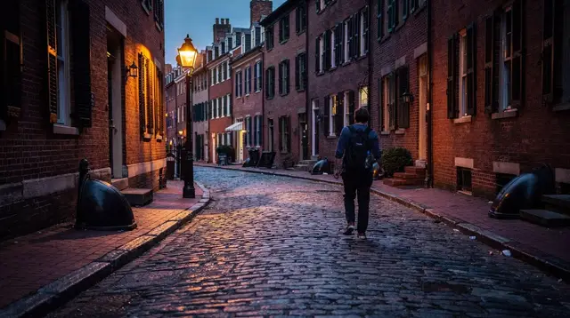
The North End earns its reputation through density of history and food — narrow streets, colonial-era buildings, a strong Italian-American identity built up over more than a century. Beacon Hill trades on brick rowhouses, gas lamps, and quiet residential streets that have looked more or less the same since the 19th century. The Seaport offers none of that, deliberately. What it offers instead is space: wide sidewalks, open harbor views, new construction that doesn’t have to work around 300-year-old street grids.
If you want a second point of comparison closer to the Seaport geographically, the South End neighborhood guide covers a district that sits at almost the opposite end of the spectrum from the Seaport in feel — Victorian rowhouses, a strong arts and dining scene built up organically over decades, rather than delivered as a planned district. Visiting both back to back is one of the more useful ways to understand how differently Boston’s neighborhoods have developed.
For visitors who want the older side of that contrast explained rather than just walked past, a guided tour of Beacon Hill and Back Bay covers the brick rowhouses, gas lamps, and 19th-century street grid that the Seaport deliberately doesn’t have:
a walking tour of Old Boston, Beacon Hill, and Back BayPairing that tour with an afternoon in the Seaport — on the same day or on separate days of a longer stay — is a fairly direct way to feel the difference the rest of this section describes in words: one half of the day in a neighborhood that’s grown for two centuries, the other in one that was largely built in the last twenty years.
None of this is an argument for skipping the Seaport. It’s an argument for knowing what you’re getting: harbor views and contemporary architecture rather than centuries of layered history. For a first-time visitor with only a day or two in Boston, the historic core — the Freedom Trail, the North End, Beacon Hill — is the higher priority. For a longer stay, or for anyone specifically drawn to waterfront architecture, art, or seafood dining, the Seaport earns its own afternoon.
Planning a Seaport stop
Treat the Seaport as a half-day add-on rather than a full day. Most first-time visitors pair it with one of two things: a harbor cruise or whale-watching trip that departs from a nearby pier, or a walk over from South Station on the way to or from a train. Trying to combine it with a full Freedom Trail day tends to feel rushed, since the two areas don’t connect on foot in under 20 minutes and don’t share a visual logic that makes for a smooth walking transition.
If getting around without renting a car is a concern more broadly, the MBTA and the T guide and the getting around Boston without a car guide cover the Silver Line alongside the rest of the system, including where it does and doesn’t overlap with the subway lines proper.
| Seaport at a glance | Detail |
|---|---|
| Character | Rebuilt waterfront district, mostly post-2000s construction |
| Main draws | Harbor views, public waterfront space, the ICA, seafood dining |
| Transit | Silver Line (SL1/SL2/SL3) from South Station, or a 10–15 min walk |
| Nearby landmark | Boston Convention and Exhibition Center (BCEC) |
| Contrast | Opposite look and feel from the North End or Beacon Hill |
| Best paired with | Harbor cruise, whale watching, or a South End comparison stop |
For a broader look at the harbor itself — cruises, ferries to the islands, and the waterfront beyond the Seaport specifically — see the Boston Harbor destination page and the things to do near Boston Harbor.
Seaport district: frequently asked questions
Is the Seaport part of downtown Boston?
It’s adjacent to downtown, across the Fort Point Channel, but it developed on its own timeline and looks nothing like the older core. Most visitors treat it as a separate stop rather than an extension of the Freedom Trail area.
How do I get to the Seaport without a car?
The MBTA Silver Line (SL1, SL2, SL3), a bus rapid transit route rather than a subway line, runs through the Seaport and connects to South Station. It’s also a walkable 10 to 15 minutes from South Station or downtown across the Fort Point Channel.
Is the Seaport worth visiting if I’ve already done the Freedom Trail?
It depends what you’re after. The Seaport has no colonial history to speak of; it’s worth a visit for harbor views, contemporary architecture, the ICA, and waterfront restaurants, not as a substitute for the historic sites.
What is there to do in the Seaport besides eating?
Harbor-facing public spaces and walkways, the Institute of Contemporary Art, and access to harbor cruises, whale watching, and boat tours that depart from the surrounding waterfront.
Is the Seaport walkable?
Yes, the district itself is flat and compact, built around a grid of newer streets close to the water. It’s the walk to and from downtown, across the Fort Point Channel, that adds the extra 10 to 15 minutes.
Does the Seaport feel like the rest of Boston?
No, and that’s the point for some visitors and the disappointment for others. It’s glass-and-steel construction from the last two decades, not brick rowhouses or cobblestone, which puts it at the opposite end of the city’s look from the North End or Beacon Hill.
Is the Institute of Contemporary Art (ICA) in the Seaport?
Yes, the ICA sits directly on the Seaport waterfront. Hours and admission change, so check ica.org before visiting rather than relying on a guide for the current schedule.
Neighborhood tours of the North End, Beacon Hill and Cambridge on GetYourGuide
Verified deep-linked GetYourGuide tours. Book through these links and we earn a small commission at no cost to you.
GetYourGuide does not provide a product photo for this activity — the image shows the meeting point, photographed by us.