A wheelchair-accessible Boston itinerary: 2 days, flat routes
Why this route, and what “accessible” means here
Boston is an old city, and its street grid shows it: brick sidewalks in Beacon Hill, narrow lanes in the North End, cobblestone patches along parts of the Freedom Trail. None of that makes the city off-limits, but it does mean a two-day plan for wheelchair users works better when it is built around known-flat corridors rather than a checklist of famous sights in whatever order they appear on a map.
This itinerary favors Boston Common, the Public Garden, Back Bay, the Boston Harborwalk and Cambridge — all places with wide, largely level paths — while flagging Beacon Hill’s brick sidewalks and some North End side streets as areas to approach with more caution rather than to avoid outright. Nothing here is described as “100% accessible.” Surfaces change block by block, construction happens, and equipment like station elevators can be out of service on any given day. Where a detail depends on a specific vehicle, vessel or piece of infrastructure, this guide says so and tells you where to verify it rather than inventing a spec.
For a broader reference on accessible sights and transport across the city, see the Boston accessibility guide and accessible tours and cruises. This itinerary is the two-day version of that research, sequenced to minimize backtracking and avoid the roughest pavement.
Day 1: Boston Common, Back Bay and Copley Square
Morning: Boston Common and the Public Garden
Start at Boston Common, the oldest public park in the United States, dating to 1634 and free to enter every day of the year. Its main paths are wide, paved and largely flat, which makes it a comfortable starting point rather than a stop that needs careful routing. From the Common, cross into the adjoining Public Garden, also free. The Public Garden’s perimeter paths are paved and level; a few interior paths are gravel, so staying on the main walkways is the more predictable choice if surface consistency matters to you. The Swan Boats that operate on the Public Garden’s pond are a paid, seasonal add-on (roughly mid-April to early September, weather-dependent) — not something to plan around for this itinerary.
Midday: Quincy Market
From the Common, head toward Quincy Market, part of the Faneuil Hall marketplace complex. It is a covered, flat, indoor-and-arcade food hall with dozens of counters, which makes it a low-effort lunch stop regardless of weather or fatigue level by midday. It’s busy — expect crowds at peak lunch hours — but the floor itself is level throughout.
Afternoon (2pm–5pm): Back Bay and the Boston Public Library
Move into Back Bay, a neighborhood built largely on 19th-century landfill with a regular street grid and brownstone rowhouses along Newbury Street and Commonwealth Avenue. The centerpiece for this itinerary is the Commonwealth Avenue Mall, a wide, tree-lined, flat pedestrian promenade running down the center of Commonwealth Avenue for roughly a mile and a half. It’s one of the more consistently level long walks in the city and a good way to see Back Bay’s architecture without navigating narrow or uneven sidewalks.
End the afternoon at the Boston Public Library’s central branch in Copley Square, a public building with elevators connecting its floors — a reliable indoor stop if you want to rest, and worth the visit on its own for the Bates Hall reading room and the interior courtyard. As with any building, if you need a specific elevator or entrance, it’s worth a quick call ahead to confirm it’s in service that day rather than assuming.
If you’d rather see Back Bay’s history with a guide who can point out what a self-guided walk might miss, a walking tour built around the neighborhood’s history is one option:
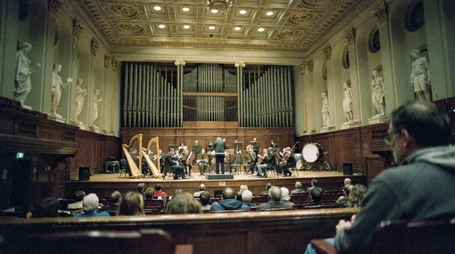
a guided walk through Back Bay tracing its women’s suffrage historyEvening: Copley Square
Copley Square itself — the plaza in front of the library, facing Trinity Church — is flat, open and a reasonable place to end the day before heading to dinner nearby. Back Bay and the South End around it have a dense concentration of restaurants at street level; ground-floor seating is common but not universal, so it’s worth checking a specific restaurant’s entrance before you commit if step-free access matters.
Day 2: Boston Harbor, the Seaport and Cambridge
Morning: the Harborwalk and Boston Harbor
Boston’s Harborwalk is a public walking path that runs along much of the working waterfront, including stretches through the Seaport District and around the Long Wharf and Rowes Wharf area. The paved sections along the harbor are flat and purpose-built for pedestrian use, which makes this a comfortable morning even without a specific destination in mind — you can walk as much or as little of it as suits your pace.
If you’re considering a harbor cruise, a sunset sail or a ferry to the Boston Harbor Islands, be aware that boarding a boat is a different situation from walking a paved path. Gangway slope, the height of the boarding point relative to the dock, and available space onboard vary by vessel and can also change with the tide on a given day. This is not something a general guide can promise for every boat, so confirm accessibility directly with the specific cruise or ferry operator before booking rather than assuming it will work out on arrival.
a Boston Harbor sunset cruise is one of the better-known options if you want to be on the water — just verify boarding details with the operator first.
Midday: Seaport District
The Seaport District, built largely on reclaimed and redeveloped waterfront land, has modern streets and a high proportion of ground-floor, step-free restaurants and cafes compared with Boston’s older neighborhoods. It’s a straightforward lunch stop after a morning on the Harborwalk, with flat sidewalks throughout the immediate dining area.
Afternoon: Cambridge via the T, then the Charles River Esplanade
Cambridge is a separate city from Boston, across the Charles River, and it’s where Harvard University and MIT are located — not in Boston itself. The most direct way there is the T’s Red Line to Harvard or Kendall/MIT.
This is the one part of the two days where a genuine point of caution applies: the T is not uniformly accessible station by station. The MBTA has installed elevators at many stations, but not all, and some of the existing elevators are older and are occasionally out of service for maintenance or repair. Before you travel, check the current elevator status for the specific stations on your route on mbta.com, and have a backup plan — a taxi or rideshare — in case an elevator you were counting on is down that day. This guide won’t invent a specific ramp or elevator detail for you; it’s genuinely worth verifying same-day.
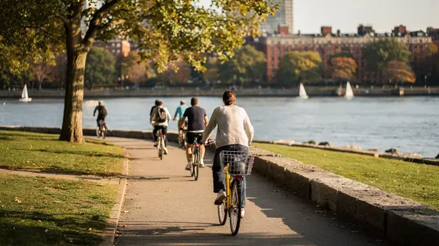
Once in Cambridge, Harvard Square’s main streets are walkable, though Harvard Yard itself has some uneven brick paths that are worth navigating slowly rather than assuming are level throughout. From Harvard Square or Kendall/MIT, the Charles River Esplanade — a paved, flat riverside path on the Boston side of the Charles — is a pleasant way to end the day, whether you cross back on foot via one of the bridges or return by T.
Two lower-key ways to see Cambridge if you’d rather not navigate it solo:
a guided walking tour of Harvard Square and the surrounding campus, or, for something lighter, a walking tour built around Harvard Square’s donut shops.
Planning notes: what to verify before you go
| Element | What to check | Where |
|---|---|---|
| T station elevators | Whether the elevator at your specific station is in service | mbta.com |
| Freedom Trail sections | Which stretches are paved vs. uneven brick or cobblestone | /guides/freedom-trail-accessibility-guide/ |
| Any harbor cruise or ferry | Boarding ramp, gangway slope, onboard space for that vessel | Directly with the operator |
| Boston Public Library elevators | Whether a specific floor’s elevator is running that day | Call ahead |
| Restaurant entrances | Step-free access at a specific address | The restaurant directly |
None of these are things a general itinerary can guarantee months or even days in advance — infrastructure and equipment status change, and the honest answer is to verify close to your travel dates rather than rely on secondhand claims.
Accessibility FAQs for a wheelchair-friendly Boston trip
Is the Freedom Trail wheelchair accessible?
Parts of it are. The trail is a painted line on public sidewalks connecting 16 sites across several neighborhoods, and surface quality varies by block — some stretches are smooth pavement, others (notably around Beacon Hill) are uneven brick or cobblestone. See the Freedom Trail accessibility guide before deciding how much of the 2.5-mile (4 km) route to walk.
Is the T accessible for wheelchair users?
Not uniformly. Many but not all MBTA stations have elevators, and some older elevators are occasionally out of service. Check mbta.com for the current status of the specific stations you plan to use, and see the MBTA guide for how the system fits together.
Are Boston Common and the Public Garden accessible?
Yes for the main paths — both are free, and their principal walkways are wide and paved. A few interior Public Garden paths are gravel rather than paved.
Can I take a harbor cruise or ferry in a wheelchair?
It depends on the specific vessel. Boarding ramps and onboard space vary by boat and by tide, so confirm directly with the operator of any cruise or ferry before booking.
Is Cambridge accessible from Boston without a car?
Yes, by Red Line to Harvard or Kendall/MIT, or on foot across a bridge over the Charles River. Cambridge is its own city, separate from Boston; Harvard Yard has some uneven brick paths worth navigating carefully.
Is the Boston Public Library accessible?
The central branch in Copley Square is a public building with elevators between floors. Confirm same-day status for a specific elevator if it matters for your visit.
Is the North End’s cobblestone a problem for wheelchairs?
Some smaller side streets have genuinely uneven historic brick or cobblestone surfaces, while main thoroughfares like Hanover Street are smoother. It’s worth planning a specific route through the North End rather than wandering at random.
Related reading
For more on getting around without a car, see getting around Boston without a car and the wider Boston museums guide if you want to add an indoor, elevator-equipped stop to either day. For things to do specifically around the harbor or in Cambridge, see things to do near Boston Harbor and things to do in Cambridge. If two days feels tight and you’d rather see a non-accessibility-focused version of a first Boston visit for comparison, the two-day Boston highlights itinerary covers similar ground at a faster pace.
Tours for your first trip to Boston on GetYourGuide
Verified deep-linked GetYourGuide tours. Book through these links and we earn a small commission at no cost to you.
GetYourGuide does not provide a product photo for this activity — the image shows the meeting point, photographed by us.