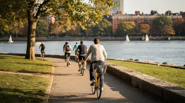
Where Boston sits on the map
Boston is the capital of Massachusetts, in the New England region of the northeastern United States. The city itself holds roughly 650,000 to 675,000 residents according to recent Census Bureau estimates, while the wider Greater Boston metropolitan area runs somewhere in the range of 4.8 to 5 million, depending on which boundary is used. Those are two different numbers describing two different areas — check census.gov if you need a precise figure, since the metro definition varies by source.
The city runs on Eastern Time: EST (UTC-5) in winter, EDT (UTC-4) in summer. Massachusetts observes the clock change, from the second Sunday in March to the first Sunday in November — the same practice as most of the US, but not the same dates as the European switch, so double-check the date if you’re arriving close to either changeover.
Getting in: Logan International Airport
Boston’s one major airport is Logan International Airport (BOS), unusually close to downtown for a city of this size. There’s no direct train from the terminals into the city. Instead, two free connections do the job: the Silver Line (SL1) bus runs from the airport to South Station at no charge in that direction — the return trip is a paid T fare like any other Silver Line ride — and a free Massport shuttle links each terminal to Airport station on the Blue Line, where a standard T fare applies from there. A seasonal ferry also connects Logan to the city; check massport.com for current schedules rather than assuming it runs year-round.
The T, the Commuter Rail, and Bluebikes: three different systems
Boston’s transit runs on a system locals call “the T,” operated by the MBTA. It has four subway lines — Red, Green, Orange, and Blue — plus a Silver Line of bus rapid transit, and an extensive local bus network. Fares are paid with a CharlieCard or CharlieTicket; check mbta.com for the current per-ride fare, since it changes periodically and this guide won’t guess a figure that will be outdated within the year. The T does not run 24 hours a day — service stops late at night and resumes in the morning, with the exact last-train time varying by line, so plan an evening out around it rather than assuming a late ride home.
The Commuter Rail is a separate network from the T, with its own ticketing, and it’s the one you’ll use for several of this site’s day trips — Salem, Plymouth, and Concord are all reachable from North Station or South Station by Commuter Rail rather than subway. Bluebikes, the city’s bike-share system, is unrelated to the MBTA network entirely; don’t expect a T fare or CharlieCard to work on it.
For a full breakdown of fares, lines, and which system handles which trip, see the guide to riding the T and the notes on getting around Boston without a car.
A compact, walkable core
Unlike many American cities, downtown Boston wasn’t laid out on a grid — its streets trace colonial-era paths, which makes for a dense, walkable core but occasionally confusing navigation. First-time visitors get more out of a paper map or phone GPS than trying to memorize a street pattern. The historic center is genuinely small: most of what draws visitors sits within a few square kilometers, distinct from the much larger residential sprawl of Greater Boston beyond it.
Within that core, a handful of neighborhoods do most of the work:
- The Freedom Trail is a roughly 2.5-mile (4 km) walking route connecting 16 Revolutionary War sites, from Boston Common to Bunker Hill. It’s a route, not a single place — following the painted red line is free, though several of the sites along it sell their own tickets.
- The North End is Boston’s Italian neighborhood, dense with bakeries and family-run restaurants.
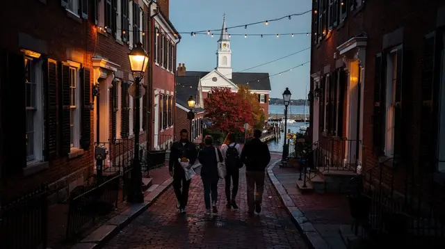
- Beacon Hill is a residential district of brick rowhouses and gas lamps just north of Boston Common.
- Boston Harbor and the Seaport cover the waterfront, harbor cruises, and the newer Seaport district.
- Back Bay and the neighboring South End hold brownstone-lined streets, Newbury Street shopping, and a strong restaurant scene.
- Fenway is home to Fenway Park, the oldest ballpark still in use in Major League Baseball, along with the Museum of Fine Arts nearby.
For orientation before you land, the first-time Boston guide and how many days you need in Boston cover pacing in more detail, and a two-day highlights itinerary or a three-day first-visit itinerary can structure a short trip.
Cambridge: across the river, not a neighborhood of Boston
Cambridge is a separate city from Boston, on the other side of the Charles River, reachable by the Red Line or on foot across one of several bridges. Harvard University and MIT are both in Cambridge, never in Boston proper — a distinction worth keeping straight, since guidebooks sometimes blur it. Harvard Yard, Harvard Square’s bookstores, and the museums of both campuses make Cambridge worth a half-day or more on its own.
Weather and when to go
Boston has a humid continental climate: summers (June to August) run warm and humid, typically 25-28°C during the day; winters (December to February) are cold, generally 0-4°C by day and below freezing at night, with snow possible from December through March. Spring arrives late and changes quickly.
Fall — late September through October — is widely considered the best season to visit, for cooler temperatures, foliage that peaks in that window (later in the city than inland), and generally lighter crowds than summer. The exception is Salem, which is at its most crowded in October, not a quiet alternative: the Haunted Happenings festival fills the town for the entire month, with crowds peaking around Halloween itself. If you’re weighing seasons more closely, the best time to visit Boston and fall foliage guide go further, and the winter guide covers what the cold months are actually like.
One date worth knowing in advance: Patriots’ Day, the third Monday in April, is also the day of the Boston Marathon — expect road closures and a citywide crowd if you’re in town then.
Seeing the harbor from the water
A harbor cruise is one of the more straightforward ways to get a first sense of the city’s waterfront and skyline, and it works well on a first afternoon before diving into any one neighborhood. For an evening on the water, a Boston sunset cruise around the harbor covers the skyline without requiring a full day, and travelers who want more time on the water can look at a tall ship sail around Boston Harbor. If the Boston Harbor Islands are on your list, a ferry out to the Boston Harbor Islands reaches them directly rather than requiring your own boat.
Walking the Freedom Trail
Because the Freedom Trail threads through several of the neighborhoods above rather than sitting in just one, it’s worth deciding early whether you want to follow it on your own or with a guide. Following the red line yourself costs nothing; a guided walk along the Freedom Trail adds context at each stop for those who’d rather not research all 16 sites beforehand. The trail’s official caretakers also run a costumed version, the official Freedom Trail guided tour, which follows the same route with actors playing historical figures. The full route, site by site, is covered in the Freedom Trail guide.
Where the day trips lead
This site treats Boston as a base for exploring the wider region, and covers day trips in three general directions.
North of the city, the North Shore covers Salem, with its witch trial history and working fishing harbor, and the Revolutionary War sites at Lexington and Concord, both within about an hour of Boston. The Salem and North Shore day trip itinerary lays out a single-day version.
South of the city, day trips reach Plymouth, the Cape Cod peninsula, and the islands of Martha’s Vineyard and Nantucket, the last two reached only by ferry from Woods Hole or Hyannis and strongly seasonal — service thins out considerably once summer ends. The Cape Cod and Provincetown getaway itinerary covers a longer version of that trip.
Further out, day trips by train, bus, or car reach beyond Massachusetts entirely: Newport and its Gilded Age mansions in Rhode Island, Providence, Portland and Kennebunkport on the Maine coast, Portsmouth in New Hampshire, and Mystic in Connecticut. None of these are in Massachusetts, and it’s worth being clear about that before planning a day around one — the day trips hub lists all of them together with realistic travel times.
Getting oriented before you book anything
Before booking tours or lodging, it helps to have a working sense of which neighborhood to stay in and how many days the trip actually needs — Boston rewards a slower pace more than a checklist. The city-wide tours and passes covered on this page — trolleys, duck tours, harbor cruises, and airport transfers — are the ones that cover Boston as a whole rather than a single neighborhood; the things to do hub breaks the rest down by category and by neighborhood.
Money matters: taxes and prices
Massachusetts charges a general sales tax of 6.25% on most purchases, with an exemption for clothing items priced under $175 — worth knowing before assuming a price tag already includes tax. Restaurant meals are taxed differently: the meals tax runs around 7% in Boston, combining the 6.25% state rate with a 0.75% local option the city adds on top, so a dinner bill and a retail purchase won’t carry quite the same percentage. Hotel stays carry a separate tax again, stacking state, city, and convention-center-fund charges into a combined rate usually quoted around 14-15% in Boston — check boston.gov for the current figure, since this rate has shifted in recent years and this guide won’t repeat a number that might already be out of date by the time you book.
None of this is specific to tourists: locals pay the same rates. But it does mean a quoted hotel rate or restaurant menu price is rarely the final number, and budgeting a little extra on top of both is the safer habit.
Free things and what costs money
Not everything in Boston requires a ticket. Boston Common and the adjoining Public Garden are both free to walk through at any hour, though the Public Garden’s Swan Boats charge a fare and only run seasonally, roughly spring through early fall. Following the Freedom Trail’s painted red line costs nothing at all — it’s the individual sites along the way, not the walk itself, that sometimes charge admission. The USS Constitution, the warship berthed in the harbor, is free to board, even though the adjacent USS Constitution Museum runs on a suggested donation rather than a fixed ticket price.
Several of the city’s best-known indoor attractions do charge admission: the Museum of Fine Arts, the Isabella Stewart Gardner Museum, the Museum of Science, and the Boston Tea Party Ships & Museum all sell tickets, as does a guided tour inside Fenway Park itself. Mixing free outdoor time — the Common, the Public Garden, the Freedom Trail’s walk — with a couple of paid museums tends to balance a trip better than trying to see everything with a ticket attached. The free things to do in Boston guide rounds up more no-cost options for travelers pacing a budget across a longer stay.
Boston FAQ: airport, transit, and getting oriented
Is Boston in Massachusetts or New England?
Boston is the capital of Massachusetts, which is one of the six states that make up the New England region in the northeastern United States.
How do I get from Logan Airport into Boston?
There’s no direct train. The Silver Line (SL1) bus is free from the airport to South Station and a paid fare on the return trip, and a free Massport shuttle connects each terminal to Airport station on the Blue Line, with a standard T fare from there.
What’s the difference between the T, the Commuter Rail, and Bluebikes?
The T is the MBTA subway and bus network within Boston and Cambridge; the Commuter Rail is a separate railroad with its own tickets that reaches the suburbs and day trips like Salem and Plymouth; Bluebikes is an unrelated bike-share system. None of the three share fares or cards.
Is Cambridge part of Boston?
No. Cambridge is a separate city across the Charles River, home to Harvard University and MIT, reached from Boston by the Red Line or on foot across a bridge.
Does the T run all night?
No. Service stops late at night and resumes in the morning, with exact times varying by line — check mbta.com for the last train before planning a late return.
When does Boston get its fall foliage?
Foliage typically peaks from late September to late October, later within the city than in inland New England, and it’s generally considered the best season to visit for cooler weather and lighter crowds than summer.
Does Massachusetts observe daylight saving time?
Yes. Massachusetts moves between EST (UTC-5) and EDT (UTC-4), from the second Sunday in March to the first Sunday in November, like most of the United States.
How many days should I plan for Boston?
Three to five days covers the city’s core neighborhoods at a reasonable pace; add extra days for any of the day trips north, south, or further afield that this site covers.